Temperature:      Wind Speed:      Gust:      Wind Chill:      Direction:    Switch to Metric

About adm_mwobs

This author has not yet filled in any details.
So far adm_mwobs has created 3789 blog entries.

July 2022

2022 Seek the Peak Photos

2022 Seek the Peak Photos

2022-07-20 10:40:15.000 – MWOBS Staff, Contributed photos.


Thanks to our 2022 Seek the Peak fundraisers, sponsors, volunteers, Vendor Village exhibitors, and visitors, our 22nd annual event was a huge success, helping us raise an impressive $175,000!
 
That’s a critical portion of our annual budget and will help sustain Mount Washington Observatory’s work in mountain meteorology and climate science.
 
Mount Washington Observatory is celebrating 90 years this fall, and Seek the Peak is a critical fundraising event to keep our nonprofit going another nine decades.
 
Next year, Seek the Peak will return on July 14-15, 2023. We look forward to seeing you there!

 
View images from last weekend’s event below.
 
Adventure Expo visitors tune in to the annual gear giveaway.
 
Pack fitting was offered at the EMS and Backpacker Magazine booths.
 
EMS field experts get ready for the expo to open.
 
Seek the Peak hikers enjoy views from the Observation tower during a tour of our summit weather station.
 
Seek the Peak team ‘The Seekers’ are shown atop Blueberry Mountain. 
 
 
Oboz Footwear, a 2022 Presenting Sponsor, provided insole fitting at the expo. EMS photo.  
 
Carrie Slife of MWOBS visits with Mel Elam and her cat Flokie at Tuckerman Brewing Co. Friday night at the Seek the Peak kick-off party. Mel and Flokie have summited all of New Hampshire’s 4,000 footers together.
 
Seek the Peak hikers visit the Backpacker Get Out More Tour booth. EMS photo.
 
Randy Propster of Backpacker helps a visitor with pack fitting. 
 
The Bear Mountain Band performs at the expo.
 
Cotopaxi brought tons of color to the expo. EMS photo.
 
The gear giveaway.
 
Hyperlite Mountain Gear was one of our 2022 sponsors.
 
Granite Backcountry Alliance was one of our sponsors. EMS photo.
 
Visitors learn about our weather and climate work in the White Mountains at the MWOBS booth.
 
Randy Propster of Backpacker and Carrie Slife of MWOBS pull raffle tickets as the gear giveaway begins.
 
A MWOBS parking volunteer greets the camera enthusiastically by the food trucks.
 
An expo visitor enjoys music performed by the Bear Mountain Band. EMS photo.


MWOBS Staff, Contributed photos.

June 2022

Saying Farewell to the ‘Home of the World’s Worst Weather’

Saying Farewell to the ‘Home of the World’s Worst Weather’

2022-06-27 17:27:39.000 – Jackie Bellefontaine, Weather Observer & Education Specialist


Great memories and great people. 
 
In January 2021, I started an incredible adventure here at Mount Washington Observatory as an intern, followed by joining our summit staff that following March as a weather observer and education specialist. Over my time here, I have grown in many ways and have found a home on the summit.
 
I’m so fortunate for my experiences and the amazing people who make up the summit — my fellow observers who are truly incredible individuals, the fabulous volunteers, our enthusiastic interns, the awesome NH State Parks crew, and the Observatory’s dedicated staff down in the valley (I could go on and on with the adjectives to describe all the wonderful people I’ve been lucky to meet up here!).
 
Thank you all for making my time here truly something special. I will miss the extreme weather, the challenges and the learning experiences of this unique place, but I will miss the people most! A very special thank you to my shift. The memories we made on the summit will always be very dear to me.
 
I’m excited for the next chapter in my life continuing on with science outreach in the New Hampshire Lakes Region, and so incredibly grateful for all the experiences from my time at Mount Washington Observatory. I’ll always carry them with me.
 
Thank you again, everybody, for your support during my time here. I can’t wait to see what the future holds for all of you incredible people!
 
Until next time!
 
With all my heart,
 
Jackie


Jackie Bellefontaine, Weather Observer & Education Specialist

From the High Arctic to Mount Washington’s Alpine Tundra

From the High Arctic to Mount Washington’s Alpine Tundra

2022-06-20 13:43:57.000 – Hayden Pearson, Weather Observer & Education Specialist


Hayden Pearson driving to fieldwork in central Spitsbergen. Image taken by fellow researcher Cody Barnett.Hayden Pearson driving to fieldwork in central Spitsbergen. Image taken by fellow researcher Cody Barnett.
 
Transitioning from working in the high Arctic to the top of Mount Washington has had its fair share of similarities. My name is Hayden Pearson and I am the newest Weather Observer and Research Specialist working here on New England’s tallest peak.
 
I am incredibly excited for this opportunity to contribute to the work being done up here at the Observatory and get settled into life on the summit. I am originally from New England, growing up in southern Maine and spending much of that time exploring the outdoors of New England. Hiking through the White Mountains in the summer and skiing throughout the country in the winter developed a passion for the outdoors and occurrences within our natural world.
 
These experiences led me to getting a degree in Earth and Climate Sciences from the University of Maine before eventually moving to Tromsø, Norway to pursue a Master’s degree, studying how glaciers react to changing atmospheric and oceanic conditions in western Greenland and central Spitsbergen. Velocity and strain analysis were conducted across the glacial terminus and compared with meteorological conditions and the state of the sea ice while in place.
 
During both my undergrad and graduate degree programs, I was able to live and work in the Arctic, and I have noticed some stark similarities between living on the top of Mount Washington and the top of the world. The lack of trees and other tall vegetation here in the high alpine regions of the White Mountains reminds me of the Arctic tundra. While the weather can change just as fast at 70+ degrees north, the winds generally are not as high on a daily basis. Additionally, much like in the Arctic, on the summit when you get nice weather and sunny skies, you take advantage of them because they are few and far between!
 
Ski touring in Svalbard. Image taken by fellow researcher Joe Buckby.Ski touring in Svalbard. Image taken by fellow researcher Joe Buckby.
 
The winter on top of the mountain is what really got me interested in applying for a position at Mount Washington Observatory. While this period of the year may seem cold and isolating for some, I find it is when the environment really comes alive. The snow and rime ice provide endless fascination as they are constantly changing and reforming based on the current meteorological conditions.
 
My first shift on the summit was a treat because we had several nice days allowing for an evening hike after dinner. We were also able to spend time looking for the visual land markers that let us determine the extent of visibility from the summit before inevitably getting socked in the fog again as the week progressed.
 
Hayden Pearson and Jackie Bellefontaine, both Weather Observers/Education Specialists (UMaine alums taking over the summit!).Hayden Pearson and Jackie Bellefontaine, both Weather Observers/Education Specialists (UMaine alums taking over the summit!).

 
Life at the Observatory has been taken up with a lot of trainings so far in order to learn all of the nuances of taking weather observations but also just making sure everything is running smoothly each day at the weather station. The highlights of the evening include sitting down for a family-style dinner and hearing about each person’s day before taking time to study the METAR booklet or challenging the NH State Parks staff to a round of Mario Kart.
 
For anyone who doesn’t know what METAR (METeorological Aerodrome Report) is, it is the standardized guide that observers follow for writing and coding all of the weather seen here on the summit. All of the current staff have been a huge help in learning how to translate the weather we document outside into METAR code, as it can be quite a challenge at times. I’m excited to see what future adventures arise from working here and to keep learning all the neat things that make this the “Home of the World’s Worst Weather”!


Hayden Pearson, Weather Observer & Education Specialist

May 2022

Mt Washington Summer Season 2022 Information

Mt Washington Summer Season 2022 Information

2022-05-23 19:25:29.000 – Ryan Knapp, Weather Observer/Staff Meteorologist


With summer quickly approaching, you might be looking for information to plan a visit to the summit of Mount Washington. There are various entities that make up a visitor’s experience in the summer. It’s important to plan according to the different schedules of these organizations. So, below are some references you can utilize to help your visit go smoothly.
 
Mount Washington Observatory:
 
Weather Station Tours – Our tours return this summer and will be available to Observatory members when the Mt. Washington State Park Sherman Adams Visitor Center is open to the public (see below). These tours now require a reservation prior to your visit. For information about how to reserve a spot and other policies, please click HERE.
 
Observatory Tours are a member benefit offered to Mount Washington Observatory members who make a donation of at least $60 a year or $5 a month per household. If you are not a member and would like to join our unique community of donors, you can make a donation online HERE and enter your Transaction ID number when you register.
 
Our Extreme Mount Washington museum is located inside the Mt. Washington State Park Sherman Adams Visitor Center; it is open whenever the NH State Park Visitor Center is open to the public (see below). Additional information is available HERE.
 
If you are planning a hike, you should always check out a forecast in order to dress and pack accordingly. Mount Washington Observatory produces a 48-hour Higher Summits Forecast twice a day and post it by 5 am and 5pm available HERE.
 
Mount Washington State Park:
 
Mt. Washington State Park, Sherman Adams Summit Building, Concession, Tip Top Historic Site operating hours are available halfway down their website HERE. Note that the Historic Tip Top House is closed for the start of the season as interior renovations are finished. Hours are subject to change, so please check their webpage and/or contact them directly (information at the top of their page) for the most current information.
 
Mt Washington Auto Road:
 
Information for the Mt Washington Auto Road can be found on their website HERE and their schedule of operation is available HERE and their various rates are available HERE. Hours of operation are subject to change, so please check their page, their social media pages, and/or contact them directly for the most current information.
 
The Mount Washington Cog Railway:
 
Information for the Mount Washington Cog Railway can be found on their website HERE and their schedule and ticket information is available HERE. Hours of operation are subject to change, so please check their page, their social media pages, and/or contact them directly for the most current information.
 
White Mountain Huts of New Hampshire:
 
Information about the AMC network of lodges, cabins, bunkhouses, campsites, and high mountain huts is available HERE. Information about the RMC high mountain huts is available HERE. Information about the HMC cabin and tent sites is available HERE. Information about the USFS White Mountains camping and cabins is available HERE. Camping is forbidden within NH State Park property as well as above treeline (except on 2+ feet of snow) within the White Mountain National Forest and there are other various rules and restrictions to be aware, all of which are available HERE.
 
Trail and Tuckerman Ravine conditions:
 
Trail conditions can be found HERE or by reading from various forums or Facebook Groups available. Tuckerman Ravine conditions, when available, can be found on the Mount Washington Avalanche Center page HERE.
 
Sunrise from the summit of Mt Washington, NH at Mount Washington Observatory on 19 May 2022Sunrise from the summit on 19 May 2022


Ryan Knapp, Weather Observer/Staff Meteorologist

Research to Look at Near-Surface Lapse Rates: the Amount of Temperature Change with Elevation

Research to Look at Near-Surface Lapse Rates: the Amount of Temperature Change with Elevation

2022-05-17 18:55:34.000 – Jay Broccolo, Weather Observer & Meteorologist


The MWOBS automated weather station at elevation 4,300 feet, part of the Mount Washington Regional Mesonet.
 
We recently completed a technical overview of the Mount Washington Regional Mesonet (MWRM) for submission to a scientific journal. The paper coalesces the history, metadata, instrumentation, functions, and uses of the MRWM, our network of remote weather stations at varying elevations. The overview also explains the value of a mesonet in the White Mountains along with the unique challenges presented by the terrain and harsh weather.
 
The overview is beneficial not only for our work but also other organizations that operate a series of automated weather stations in close enough proximity to measure, record, track, and communicate mesoscale meteorological phenomena. By mesoscale, I am referring to an area larger than microscale, like a town or city’s environment, but smaller than synoptic scale, a large country or continent. Mesoscale, typically between tens of kilometers to several hundreds of kilometers, essentially refers to an area large enough to encapsulate storm-scale systems, like cyclones, extra-tropical cyclones, frontal systems, and squall lines.
 
Organizing all of this information will make it much easier for MWOBS observers and the scientific community to access this information as well as assist other mesonet system administrators to overcome some of their own unique challenges, establish a new mesonet, add further stations to one in existence, or maybe spark some new ideas and technology solutions.
 
We look forward to making our overview available to the public in the near future.
 
As we move into the summer, our intern program is back in full force and focused on research and weather operations. One of the research projects that will occur throughout 2022 and bring us into 2023 is the establishment of near-surface lapse rates on the windward and leeward flanks of Mount Washington.
 
One of our new summer interns, Henry Moskovitz, will be starting this project with a literature review, initial collection of data, and establishment of methods of analysis. Henry will be fortunate to get a first look at the summer seasonal lapse rates and see how they compare to what is generally known.
 
The project will make use of our MWRM, provide undergraduate research experience, and produce research that will add to the scientific community, improve our forecasting toolkit to better prepare the recreational and business community, and improve our understanding of climate change and its effects on the alpine zone.
 
As we dive into the research project this summer, let’s welcome Henry and get to know him a little bit better…
 
————————————————————————- 
 
Hi Everyone,
 
Wednesday, May 11 was my first day as the new intern on the summit of Mount Washington, and only a week prior I was finishing my last final exam at school all the way down in Daytona Beach, Florida.

After exams, I drove back to my home in Massachusetts, where I relaxed for a few days before heading up here. Apparently, I must have packed the warm weather with me before departing Florida because the ridge, currently sitting over us and producing record-high temperatures, looks like it was dragged up Interstate 95.

 
While on the subject, temperatures will comprise much of my work here this summer. My mentor, Weather Observer and Meteorologist Jay Broccolo, has begun providing me with a rough overview of the research that I’ll be helping him complete.
 
Jay has been developing a study to establish near-surface lapse rates on Mount Washington. In more simple terms, this means we are looking to determine how the air temperature changes up and down the mountain under different conditions. Establishing more accurate baselines for these lapse rates will help with forecasting precipitation and predicting the effect(s) that changing temperatures will have on the local alpine climate and the surrounding environment.
 
I am very excited to participate in this important work and I am already finding the observatory to be a dynamic, engaging workplace. I look forward to all I will get to learn this summer!
 
–Henry
 
 Henry Moskovitz


Jay Broccolo, Weather Observer & Meteorologist

Spring Weather Means it’s Time to Fly (or Hike)!

Spring Weather Means it’s Time to Fly (or Hike)!

2022-05-10 08:24:31.000 – Sam Robinson, Weather Observer/Engineer


As winter starts to lose its tight grip on the higher summits this spring, the Home of the World’s Worst Weather has begun to show a bit of forgiveness. Overall, winds have relaxed a bit, temperatures have become less bone-chilling, and the snow and ice is beginning to disappear.

This seasonal improvement in weather tends to lead to increased recreational activity around the mountains but also more favorable conditions for aviation activities. Over the past few weeks, we have witnessed multiple training exercises from both American and Canadian search and rescue helicopters due to the unique terrain of the White Mountains, and the availability of the helicopter landing pad located just off the summit cone.

Our summit weather observing station submits hourly weather observations or METAR’s (METeorological Aerodrome Reports) to the National Weather Service as part of a network of nationwide stations to help keep the aviation community safe. However, we are unique and differ from most METAR weather observing stations since most stations are located at airports. While we are not an airport and we are not helping planes land, nor do we have any runways, we do have the heli pad!

Royal Canadian Airforce 413th Transport and Rescue Squadron coming in for a landing.

One of the more notable helicopter landings I’ve experienced so far this year has been the Royal Canadian Airforce, specifically the 413 Transport and Rescue Squadron from Nova Scotia. This is the first time I have seen them in our area, as they normally stay in…well, Canada! The unique mountainous terrain of the White Mountains is a great place for the squadron to train because it is similar to the terrain that they service in Canada but is also relatively close to airports (and heli-pads). This helps make the training exercises easier to coordinate, easier for the helicopter to stay fueled up, and also provides rest time for the crew when needed.

Speaking of the helicopter itself (as I am a gearhead), it is an AgustaWestland Cormorant CH-149. I believe it is the largest helicopter to routinely land up here on the summit, and appears to be one of the largest single rotor choppers I have seen and photographed here.

Crew members of the RCAF 413th Transport and Rescue Squadron taking some pictures of their own.

The large, bright yellow “Cormorant” was down in our region this past week for training, and according to an article in the Conway Daily Sun, it was the first time down here since 2019 due to the pandemic. The crew based themselves out of the Eastern Slopes Airport in nearby Fryeburg Maine.

Along with our Canadian friends from the R.C.A.F., the United States Coast Guard and Air National Guard have been doing some flights around our area this spring as well. The U.S.C.G. based out of Cape Cod, MA operates a Sikorsky MH-60T Jayhawk dressed in the very distinguishable orange and white paint scheme while the U.S.A.N.G. out of Vermont operates a Sikorsky HH-60 Blackhawk, which is used for search and rescue in our region, dressed in standard army green with a white and red cross on the side.

United States Coast Guard Sikorsky MH-60T Jayhawk on the helicopter landing pad.

 
United States Air National Guard Sikorsky HH-60 Blackhawk flying over the Great Gulf.

Another notable landing earlier this year included the US Army Chinook CH-47 twin rotor transport helicopters. These may actually take the cake for the largest helicopters to land here, they are pretty massive! It was the first time I had ever seen them fly and land up here and also the first time I had ever seen them in person. They flew in after a recent fresh snowfall, and the landing definitely kicked up an impressive snow dust cloud. Definitely was a sight and sound that I will never forget!

United States Army Chinook twin-rotor transport helicopter landing with its twin flying in the background.

Although most of you probably are not trying to fly and land helicopters up here on the higher summits, you may be looking to recreate in the mountains this spring. Before heading out on your next adventure, be sure to check out our 48-hour Higher Summits Forecast in order to know what to expect up in the alpine zone. It is important to remember that while conditions in the valley and at trailheads may feel almost summer like at times, winter weather is still very possible above treeline.

If you are not looking to hike but still looking to visit the summit, be sure to check out the websites of our partners on the mountain for updated opening dates and other information, like Mount Washington State Park, the Mount Washington Auto Road, and the Cog Railway.

USANG Blackhawk heading back towards Vermont.

Enjoy the spring weather because summer will be here before we know it! Happy trails (or road / rails )! 


Sam Robinson, Weather Observer/Engineer

April 2022

A Look Back at Measuring the Extreme Winds on Mount Washington

A Look Back at Measuring the Extreme Winds on Mount Washington

2022-04-12 12:03:50.000 – Adam Muhith, Summit Intern


A range of the anemometers designed and used during the Observatory’s history, shown above clockwise from top left, include the Heated No. 2, Grandfather Pitot, Pitot 92, Pitot 94, Pitot 97, Pitot 11, and Pitot 19.
 
Today is Big Wind Day, commemorating the 231 mph wind gust recorded by Mount Washington Observatory staff on April 12, 1934.  
 
Since the earliest days of observing weather on the summit, measuring wind speeds has been a challenge. Heavy icing conditions and extreme winds are enough to damage common measurement devices, rendering them inadequate for maintaining our 90 years of continuous weather and climate data. In the early years of the Observatory, the necessity arose to have an instrument that could accurately measure high winds and maintain accuracy during severe icing.
 
To this day, there are no commercially available instruments that could survive a Mount Washington winter, let alone accurately measure wind speeds throughout the cold season. To combat this, MWOBS has accomplished numerous innovations in measuring wind speeds through the development of heated anemometers. Adding a heater allowed for these instruments to survive the summit’s icing conditions, and the Observatory has spent the decades since improving and perfecting a custom designed heated pitot anemometer.  
 
Beginning back in the late 1800s, the Blue Hill Observatory originally loaned some cup anemometers to the Observatory, beginning a record of wind speeds. However, these anemometers were non-heated, preventing a continuous record in the wintertime icing conditions. The cup anemometers remained in use as primary instruments through 1946. From then until 2005, the Observatory used them occasionally as backup anemometers in light wind and light icing conditions.
 
Attempts to overcome icing conditions led to the development of a heated anemometer, aptly named the Heated No. 1. With a new heating element, this anemometer could counter winter ice accumulation. Implemented on Nov. 9, 1932, Heated No. 1 was able to take measurements when winds were between 11-120 mph in icing conditions. 
 
After it went up, efforts to improve Heated No. 1 resulted in the Heated No. 2 becoming an operational instrument. Heated No. 2’s improvements over No. 1 included a sheltered heater with a vent around the shaft, a 700-watt double-circuit heating device, and vacuum contacts for electrical recording.
 
Heated No. 2 became the main instrument on the summit in 1933, replacing Heated No. 1. Heated No. 2 is most famous for recording The Big Wind of 231 mph on April 12, 1934, which still stands as the fastest surface wind speed ever observed by a human. Measured in extremely challenging icing conditions, the measurement was extensively verified, setting the standard of data quality for MWOBS weather observers throughout our history. The Heated No. 2 is currently on display in the Extreme Mount Washington™ museum on the summit. 
 
Shown above are Mount Washington Observatory staff Alex McKenzie, left, John Dick, and Aubrey Hustead, holding the Heated No. 2 Anemometer.   
 
 
Later on into the Heated No. 2’s lifespan, questions emerged surrounding its performance in periods of high winds and heavy icing. Beginning in the winter of 1944-45, testing for using an operational pitot tube anemometer began. The idea for using a pitot tube was borrowed from the aviation industry, since pitot tubes were proven to be able to measure wind speeds much faster than those experienced on the summit. The tubes were attached to the nose and wings of an airplane, analyzing the free-air pressure and the measured pressure at the plane, and then calculating the relative airspeed from the difference.
 
The tubes themselves were commercially available, so once determined that a pitot tube could properly measure wind speeds on the summit, all that was necessary was to build the housing. Observatory staff got creative and constructed a mast and skirt out of a repurposed tin vegetable can. With these, in 1946 the Grandfather Pitot became the Observatory’s main instrument for measuring and recording wind speeds. Its advantages over the Heated No. 2 included that it automatically corrected the barometer to free-air pressure, had no moving parts, and could accurately measure instantaneous gusts and average sustained wind speeds directly from the recorder. Previously, observers would calculate these two data points by hand.
 
The Grandfather worked well for speeds above 30 mph, but winds less than that often could not deliver the torque necessary to vane the tube into the right direction. In these instances of lighter winds, using the cup anemometers as backups came in handy. The Grandfather was then retired in 1992, and, through 2022, remains the summit’s longest-used primary anemometer. 
 
In 1990, the “Pitot Project” began, looking to build a replacement for the aging Grandfather. Primary goals of the project were to simplify maintenance and implement newer technologies to upgrade performance. The Pitot Project developed four similar pitot tubes used through the 1990s and 2000s – Pitot 92, Pitot 94, Pitot 97, and Pitot 99. Respectively, these pitots were functional instruments on the summit during 1992-2000, 1994-97, 1997-2011, and 1999-2011. 
 
Pitot 92’s design process focused on building the heated vaning assembly. It featured an improved heating system capable of fully automated and ice-free operation and custom-machined aluminum body parts alongside other commercially available components. These allowed for modular design and easier standardization of repair processes.  
 
Pitot 94 then included a new and improved heater control system, as well as a custom chart recorder interface for the Observatory’s wind direction instrument. The design improvements built a linkage between the wind direction instrument and the Pitot 94, thereby eliminating the need for one of the wind vanes. MWOBS used Pitot 94 primarily as a backup for Pitot 92. In the summer, the Observatory used the Grandfather Pitot as a backup as well.
 
As the Pitot Project continued, the Observatory analyzed various retired pitots and identified instances of inconsistent performance and calibration. Observers found very slight variances in wind direction and speed from one pitot to the next, although each measurement was within reasonable margin of error. Observers looked to ensure that all measurement tools on the summit remained consistent to one another.
 
Measures to rebuild Pitot 94 birthed the Pitot 97, which had a new heater controller subsystem, weather room display and control subsystem, pressure transducer, and data subsystem. When implemented, Pitot 97 was the primary means of accurately measuring winds up to 250 mph in any conditions. The Observatory then later rebuilt the Grandfather Pitot as the Pitot 99, serving to supplement Pitots 92 and 97 as summer and light icing backups.
 
In the 2000s, new technologies and instruments arose. Beginning in summer 2005, the Observatory has used various RM Young propeller anemometers for wind speeds below 30 mph with light-to-no icing conditions. The RM Young models replaced the use of cup anemometers. RM Young wind monitors are now used in conjunction with the pitot system throughout the summer months.
 
An RM Young propeller-driven anemometer. 
 
As time went on, Pitots 97 and 99 began to show their age. Work began to develop new pitots to replace the models. Pitot 97, the main instrument, had begun to experience recording issues before the Observatory was able to replace it. In this instance, Pitot 99 and an unnamed backup pitot served as the main recording devices.
 
Early in January 2011, work on the Pitot 11 concluded. Pitot 11 went up as Pitot 97 came down, and Observatory staff found that Pitot 97’s housing contained about a cup of water, the pressure line became disconnected, and there was significant corrosion on the wires. Pitot 11’s improvements over 97 included new heat tapes, a heated tube, and new insulation. Pitot 11 served as the Observatory’s main instrument through 2017, when Pitot 17 took its place.
 
Pitot 17, referred to as the “sister” to Pitot 11, is structurally identical to Pitot 11, with improved skirt heaters and bearings. In 2019, Pitot 17’s bearings needed replacement, so Pitot 19 took its place. Pitot 19 is again a sister pitot to Pitot 11, structurally identical to the prior two pitots. Pitot 19 included repaired bearings and features to enhance heating and to simplify data transmission. Pitot 19 is currently in use on the summit, functioning as the current primary pitot and air pressure measurement device.
 
In April 2013, a group of UMass Lowell students published a paper analyzing certain factors and their effect on the Observatory’s wind speed measurement system: tubing length between the transducer and pitot tube, system leaks, and the pitot tube’s angular orientation. They concluded and recommended to the Observatory to shorten the tubing length, implement methods to minimize leak zones, and to maintain the current pitot tube angle and mount. With these recommendations, work began to develop the Pitot 22.
 
Conceptualized as the next generation of pitot anemometers, Pitot 22 resulted from a multi-year collaboration between MWOBS, General Electric, and UMass Lowell. Its improvements include a more simplified design for easier removal and installation, shorter tube length, improved gust sensitivity, and an upgraded heating system. Construction began in 2015, and Pitot 22 was first installed on the summit in August of 2018, having been recently reinstalled in January 2022 after third-party testing from the University of New Hampshire. Currently, MWOBS is in the final stages of testing before designating Pitot 22 as the primary wind measurement instrument.
 
The Pitot 22 Anemometer. 
 
 
Adam Muhith earned a B.S. in Environmental Engineering from the University of Texas at Austin in 2021. He joined our summit team as an intern in fall 2021.  


Adam Muhith, Summit Intern

March 2022

An Uncommon Commute to Study our Weather and Climate

An Uncommon Commute to Study our Weather and Climate

2022-03-23 14:27:15.000 – Jackie Bellefontaine, Weather Observer and Education Specialist


One of the most common questions I’m asked as a Weather Observer is how my colleagues and I get to work. The logistics of getting up and down Mount Washington change depending on the season and conditions. We have several vehicles, including a van, truck, and Bombardier snowcat. The snowcat is definitely the standout vehicle that people are most curious about – understandably so!
 
The snowcat is similar to the groomers at ski resorts, with large tank-like treads and a plow on the front. But the Mount Washington Observatory snowcat is outfitted with a cab on the back that fits up to a dozen people and is used for getting observatory staff up to and down from the summit during the winter months.
 
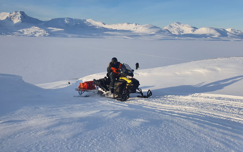
Weather Observer and Meteorologist Jay Broccolo keeps an eye on blading from the snow cat cabin window during an early March trip to the summit for our weekly shift change.
 
A typical snowcat ride starts at the base, given that there’s enough snow to go straight from base to summit. If the road is only partially covered with snow/ice, our van or truck with chains is used to take our staff part way up the road to where the snowcat is staged for the rest of the journey. When starting with the snowcat at the base, we load up the cab and side saddles with gear and groceries for the week. Then we climb aboard and the snowcat operator starts our trek up to the summit. A typical snowcat ride from base to summit takes about an hour and a half, but that’s with ideal conditions such as minimal snow drifts and good visibility. And Mount Washington isn’t exactly known for ideal conditions.
 
 Snow drifting along the lee side of Mount Washington along the auto road.
 
Due to large amounts of snow blowing over the summit and down the lee side of Mount Washington (think of all the snow that lands in Tuckerman Ravine), there are often large snow drifts on sections of the auto road that require blading, sometimes LOTS of blading. This blading (plowing) means continuous back and forth travel as drifts are cleared from the road, which isn’t great for those with a queasy stomach. Occasionally, a section of the road may require so much blading that the operator will stop to let the passengers out for fresh air and a break – if conditions are safe to do so – from the back and forth.
 
Observatory staff and guests from WBZ CBS Boston walk along the along the Mount Washington Auto Road as the snowcat clears the way
 
Large snow drifts, especially combined with other undesirable conditions such as low visibility, can make for a much longer trip up to the top (several hours!). There have also been occasions when visibility was so poor from fog and blowing snow that the snowcat had to turn around and return to the base to try again another day.
 
On long snowcat journeys, we spend our time catching up with colleagues on projects and what we did during our week off the mountain before silence settles in and everyone, or mostly everyone, falls asleep in the heated cab. Depending on the conditions, stops are occasionally made at an Mount Washington Regional Mesonet site or two to perform maintenance such as digging out solar panels from the snow.
 
The snowcat traveling up the auto road on a bluebird day.
 
Upon arrival at the summit, the current crew of observers and interns meet the snowcat at the door to start shift change by unloading gear. The crew in the snowcat begins to gather gear, or shoot out of the back of the snowcat as soon as the door opens, racing to the restroom (which is a situation I find myself in often). The now downbound crew loads up their gear, trash and laundry before joining the crew that just arrived in the weather room for shift change. Once information and maybe a few jokes are exchanged between shifts, it’s time for the downbound crew to say goodbye to Nimbus for the week and climb aboard the snowcat for a similar ride down. At the base, observers once again unload the snowcat before heading home for the week and coming back for another adventure up the road!  
 
The snowcat loaded up with gear outside of the NH State Parks’ Sherman Adams Summit Building. 


Jackie Bellefontaine, Weather Observer and Education Specialist

A Night in the Life of a Weather Observer

A Night in the Life of a Weather Observer

By Charlie Buterbaugh | March 15, 2022

Staff Meteorologist Ryan Knapp sets an anemometer on the observation tower.

Well over a mile above the valley of Mount Washington, in a weather station built into boulders deposited tens of thousands of years ago, a night observer keeps track of data through the night, maintaining one of North America’s longest continuous alpine climate records.
He is mainly focused on the minutes, completing observations between 00:49 and 00:59 past every hour. Routine and process rule the night, but no two nights make the same weather. The consistency of process, timing, and location assure continuation of a 90-year data set. Weather presents a far less reliable dimension, especially on Mount Washington, where cycles are shaped by cold fronts, warm fronts, and extreme conditions that arrive as they please.
It’s 5:30 p.m. on a mid-November Tuesday evening, and Staff Meteorologist Ryan Knapp seems accustomed to darkness, keeping the weather room dimly lit. He relieves the two day observers whose work started 12 hours ago. The transition between staff is critical. They compare notes about current conditions and forward-looking models.
“If you don’t write something down, it could quickly become too little too late,” says Knapp. “Weather systems could be arriving hours ahead of what the models are saying.”
His running analysis combines real-time observations at the summit with data charts and weather maps displayed on multiple screens. Tonight, a low-pressure system approaching from the northwest pushes dry air like a bulldozer, creating pockets between moist layers.
The meteorologist checks data quality, verifying figures entered during the prior day to keep a clean baseline. In addition to the nightly checks, the team circles back to assure quality each morning, then again every five days, and once more at the end of the month.
“That’s what goes into our 90-year record,” says Knapp, referring to the monthly review.
Before the next ob, we head downstairs for dinner in the crew’s living quarters. Seated at a long table, eating sautéed vegetables and pizzas charred by a commercial gas range, the three meteorologists and one intern debate whether the approaching cold front will bring freezing rain, sleet, or snow. Nimbus, the observatory’s gray shorthair cat named after clouds that bring precipitation, makes his presence known.
After dinner, the crew scrubs and vacuums the entire quarters, including kitchen, pantry, bathroom, bunk rooms, and living room. They’re tired but in high spirits. Snow is in the forecast. And their off week starts tomorrow after they welcome the alternating crew of observers and travel down the mountain, this time of year by pickup truck on the auto road. If the snow is deep, they’ll stop to put chains on the tires. In the back of their minds, they know the whole trip could be delayed by dense fog or high winds above tree line.
Knapp’s short dinner break ends and he heads back up to the weather room. Except for my questions, he is alone once again for a nocturnal routine he has kept for 16 years.
Just after 7:45, he gears up briskly and ascends the observation tower, opens the door beneath an A-frame protecting against chunks of rime that fly when winds accelerate, and steps onto the vast observation deck, walking in darkness to the north end. He counts two layers of clouds below and three aloft.
The meteorologist heads to the designated spot for measuring ambient air temperature, turns his headlamp on, and spins the sling psychrometer, a low-tech instrument that’s reliable in a variety of extreme conditions. This manual weather observation process has been happening the same way, every hour, since 1932. With side-by-side dry-bulb and wet-bulb thermometers, measurements are used to calculate dew point and relative humidity, the amount of water vapor in the air.
During the next ob, he climbs three flights of stairs and ladders to the top of the observation tower, perched in darkness above anywhere attached to earth in the northeastern U.S. He checks the heated anemometers and, if needed, removes ice that accumulates fast as winds accelerate and temperatures plummet. Tonight, it’s only hovering around freezing with winds gusting at 50 mph.
Heading inside, he closes the hatch at the top of the tower, quieting the west winds blowing out of the chasm of the Ammonoosuc Ravine against Mount Washington’s windward flank, and again returns to the weather room to log data, check radar, and perform other tasks until he heads outside again regardless of the weather, repeating this routine through the night.
Asked if the work ever gets monotonous, he says no. The weather is ever-changing, and knowing his work continues the 90-year data set steels his sense of purpose.
“It’s almost like having the mountain to myself,” he says. “I only have to worry about the weather.”
Data is inputted after every hourly observation through the night. 
A playlist and mug of coffee also keep him going. He responds to a question on MWOBS’ Facebook page about yesterday’s photo of a cap cloud that formed over the summit. Knapp doubles as the observatory’s photo administrator, and his summit photography has attracted a colossal following.
He’s known at the summit for rating sunrises on a scale of one to ten. A three on his scale is likely an eight or nine on ours.

But from now until early March, he’ll go to sleep before sunrise, missing the morning blue hour.

It’s approaching 1:00 a.m. and the meteorologist starts a synoptic observation, a six-hour detailed snapshot of conditions. He records maximum and minimum temperature, atmospheric pressure tendency, and precipitation types and totals. This all gets delivered to the National Weather Service. Being prompt matters. The synoptic data feeds weather models that Mount Washington’s observers and many other meteorologists rely on for accurate forecasting.
The complexity of his work increases after the 1:00 synoptic. He starts to work on the daily mountain forecasts between 2:00 and 3:00, staying keenly aware of the observatory’s backcountry audience. The Mount Washington and Higher Summits forecasts need to be posted on mountwashington.org before 5:00 a.m. The weather is always changing and the stakes are high. Search and rescue teams, climbing guides, and others rely on MWOBS’ forecasting accuracy, helping them decide when to head out, how to modify plans, or to postpone.
After a few hours of sleep in one of the cozy wood-paneled bunk rooms, I head back to the weather room and overhear Knapp recording his voice for the audio forecast. Falling snow is starting to accumulate at 5:15 when Weather Observer Sam Robinson arrives in the weather room to start his day. He fields a round of probing, collegial questions from Knapp about data points entered the previous day. It’s all part of keeping the record straight.
Knapp and Robinson stay composed as ever. With winds on the increase and a snow storm in process, care will be needed on this shift change day as the next crew makes their way to the alpine zone for another challenging week at the weather station.
Knapp reads in an observatory bunk room after completing his nightly shift. 
If you value our work, consider a donation to Mount Washington Observatory, a private, nonprofit institution. Donations directly support the continuation of forecasting, climate data, and educational work at the summit of Mount Washington. Any donation qualifies you as a member. $5 per month gives you a one-year subscription to Windswept, our member magazine where this story was originally published.
About the Author
Charlie Buterbaugh is the Director of Communications at Mount Washington Observatory.

Share This Post

Support Us

Mount Washington Observatory is a nonprofit research and educational institution working to advance understanding of Earth’s weather and climate.

We cannot do this without your support!

Brrrrr, It’s Cold Outside, but the Rime Ice is Beautiful!

Brrrrr, It’s Cold Outside, but the Rime Ice is Beautiful!

2022-03-15 14:34:34.000 – Matthew Addison, Weather Observer/Meteorologist


It’s been four months since I arrived at Mount Washington and wow, has it been chilly! In my 26+ years as a meteorologist, I can say this has indeed been the coldest weather I’ve ever experienced.
 
Of 147 days on the summit, only 28 have seen the temperature rise above freezing, which means it’s been below freezing 81% of my time here. While that may not seem too bad for most New Englanders, as a native Texan, this is a bit chilly.
 
While I do love the cold, it’s the wind that makes the temperature almost unbearable at times. During the same 147 days, the winds were blowing at or greater than hurricane strength (74 mph or higher) on 76 days, or 52% of the time. This has made wind chill temperatures dip to the lowest I’ve ever experienced in my lifetime.
 
As you may already know, the wind chill is how cold temperatures actually feel on your skin when wind is factored in. The wind chill temperature, as defined by the National Weather Service, is based on “the rate of heat loss from exposed skin caused by wind and cold. As the wind increases, it draws heat from the body, driving down skin temperature and eventually the internal body temperature.”
 
Even when properly dressed for very cold temperatures, when the wind is at or above hurricane strength, wind chill temperatures can dip to extremely dangerous levels and cut right through whatever it is you’re wearing. This past Valentine’s Day on the summit was the coldest day so far for me. We bottomed out at -24 °F with winds of 70 mph, providing a wind chill of -70 °F. I’ve experienced colder ambient temperatures before, but never a wind chill this low.
 
Winter days can create such beautiful landscapes across the White Mountains, whether it’s a new coating of snow that fell overnight or the aftermath of a night of freezing fog. With cold temperatures as common as they are on the summit, when you combine the subfreezing temperatures with foggy conditions you can get some amazing icing formations (in 2021, we had 321 days with at least some amount of fog recorded during a 24-hour period).
 
Rime ice and hoar frost are by far the most spectacular things I’ve witnessed on the summit. While hoar frost is not typically a hazard, rime ice can be extremely dangerous for aircraft. But as an observer, it’s just absolutely stunning to watch ice form throughout the night. 
 
 Rime ice forming on rocks.
 
According to the National Weather Service, rime ice is an “opaque, or milky white, deposit of ice that forms when small supercooled water droplets accumulate on the leading edges of objects that are at or below freezing.”
 
“Supercooled water droplets will freeze completely and quickly without spreading from the point of impact. Thus, the droplets retain their spherical shape as they freeze, creating air packets between the frozen particles. This process creates an irregular shape of the ice.”
 
Hoar frost is “a deposit of interlocking crystals formed by direct sublimation on objects, usually those of small diameter freely exposed to the air, such as tree branches, plants, wires, poles, etc. The deposition of hoar frost is similar to the process by which dew is formed, except that the temperature of the frosted object must be below freezing. It forms when air with a dew point below freezing is brought to saturation by cooling.”
 
Hoar frost and rime ice typically occur when fog from low-lying regions, accompanied by high winds, is blown uphill into the mountains. As fog rises and cools, its airborne water droplets cool to sub-zero temperatures without freezing. As the windborne drops make impact with objects, they immediately freeze and accumulate on each other, building towards the direction of the wind.
 
Here on the summit, rime icing and hoar frost formation happen almost daily during the winter months. Most days, the icing can grow up to three inches per hour. However, I’ve witnessed it growing over five inches per hour during our most intense weather events.
 
Below are some of my favorite photos I’ve taken of rime ice forming on different objects at and near the summit.
 
 Rime ice forming on a grade stake along the Mount Washington Auto Road.
 
 Rime ice on the observation deck railing.

 
 Rime ice on the RM Young anemometer.
 
 Rime ice is visible looking out our weather room window. 
 
Hoar frost on a temperature sensor.
 
I’m sure you can agree with me, rime ice can be a beautiful weather phenomenon to view up close. Knowing and reporting icing is an important part of being a weather observer. It’s crucial to keeping the aviation community safe. Additionally, icing can be very destructive to meteorological instruments. It can encapsulate anemometers and other meteorological instruments and if enough icing forms, this, in combination with high winds, can destroy the equipment.
 
Since icing forms frequently here at the observatory, we must remove it from our weather equipment hourly to ensure not only our weather observations are as accurate as possible, but to prevent any damage to the very costly sensors.
 
If interested in learning more about all different type of icing, I recommend visiting this link from the National Weather Service.
 
Thanks for reading!


Matthew Addison, Weather Observer/Meteorologist

Go to Top