Temperature:      Wind Speed:      Gust:      Wind Chill:      Direction:    Switch to Metric

About adm_mwobs

This author has not yet filled in any details.
So far adm_mwobs has created 3789 blog entries.

July 2021

Summit Observer in the Valley: Seek the Peak Edition!

Summit Observer in the Valley: Seek the Peak Edition!

2021-07-27 17:37:42.000 – Jackie Bellefontaine, Weather Observer/Education Specialist


Being a Weather Observer and Educational Specialist at the Mount Washington Observatory, I am fortunate to be able to engage with our local White Mountaincommunity. However, most of these interactions are done virtually as I am living on the summit for about a week at a time. So, when I heard that I would be off-shift and helping to run the Observatory booth at Seek the Peak this year, I was ecstatic! I was incredibly excited to see the outdoor community come together to help support the Mount Washington Observatory, and I was not disappointed. The Seek the Peak Adventure Expo with all it’s the fantastic vendors, local non-profits, live music and supporters of the MWObs had a contagious energy. I enjoyed walking around the Expo grounds watching participants excitedly chat with vendors and each other, further growing and connecting our community. Not even a bit of rain could dampen the mood! Over at the Observatory booth, my coworkers and I had a blast chatting about our work at the Observatory, as well as raffling off some great prizes — from a Garmin InReach to my personal favorite, the Thermarest Honcho Poncho. However, my favorite part of Seek the Peak was getting to meet all the fantastic participants and supporters of the Mount Washington Observatory. Myself and the Observatory could not be more grateful for such an engaging and supportive community. The Mount Washington Observatory would not be where it is today without you, so thank you to all of those who participated, donated, volunteered, organized and stopped by to say hello at Seek the Peak! I cannot wait to see you all again next year! 


 STP tent
Seek the Peak 2021 Adventure Expo in full swing.
 

Fantastic to see the outdoor community come together to support the Mount Washington Observatory! 


Jackie Bellefontaine, Weather Observer/Education Specialist

A Dream Coming Back as Weather Observer, Come True

A Dream Coming Back as Weather Observer, Come True

2021-07-19 16:12:27.000 – Stephen Durham, Weather Observer/Education Specialist


In January of 2019, it was a once in a lifetime experience interning at the Mt. Washington Observatory for two weeks straight. Since then, I had hoped to return to the observatory one day again, to experience and enjoy the thrilling and extreme weather, I get that opportunity again now as a weather observer and educational specialist.

 
 July 2021 Sunrise
 

The weeks and days leading up to my first to trip to the summit were surreal and hadn’t really set in until driving to the base of the Mt. Washington Auto Road this past Wednesday. There has always been a special connection for myself and Mt. Washington since even before my internship.

 
It was a unique place I had seen on television and my dad has always talked about it when I was younger from visiting New Hampshire before. When it came to college after high school, I found Plymouth State University and became interested in their meteorology program.

When I first visited Plymouth State University in February of 2014, I learned about the highly valued internship through the meteorology program. My first goal then when I got to Plymouth State was to eventually pursue that amazing opportunity.

 
January 2019  
 

That exact chance came when I found out in November 2018 with an email, learning I had been given the opportunity and would be going up to the summit for two straight weeks in January. It was surreal just to know I’d have that opportunity heading into the new year. In those two weeks, the experience of weather is unlike anything else.


My first day up-bound, was crystal clear, could see the Atlantic Ocean, and just miles upon miles. It was just an incredible day, just like the perfect way to start my internship. One of the most amazing experiences was a few days later. We had calm winds on an early morning, received several inches of snow, and just felt like a perfect snowy morning.  A few hours later, winds increased across the higher summits, with wind gusts over the century mark! It was an all-out blizzard, a meteorologist dream come true.


 January 2019 Sunset
 

After experiencing such extreme weather and gorgeous sunrises and sunsets, I wanted more, I felt determined to return one day as a weather observer. I felt like two weeks wasn’t enough at the summit. It is my dream job to be here at the Mt. Washington Observatory. Tuesday night before my first up-bound trip to the summit, I felt like a kid on the night before Christmas, excited and just ready for the new challenges that lay ahead being a weather observer and educational specialist.

You know you are in the right place in life when you wake up excited to do your job, as the common saying goes by Marc Anthony, “If you do what you love, you’ll never work a day in your life,” and I get to do that each day observing and forecasting weather in a location that I adore, love, and care about greatly. I can’t wait for the coming days, weeks, and months ahead here at the Mount Washington Observatory.


Stephen Durham, Weather Observer/Education Specialist

Seek the Peak 2021

Seek the Peak 2021

2021-07-05 11:25:03.000 – Krissy Fraser, Director of Marketing & Communications


The non-profit Mount Washington Observatory (MWO) announces the gathering of local non-profits that promote safe and responsible outdoor recreation in the state of NH as an important addition to their largest annual fundraiser Seek the Peak – Mount Washington Adventure Expo.

In an expanded event this year, Seek the Peak will culminate Saturday, July 17th from 12-7pm at the Adventure Expo, taking place at Great Glen Trails Outdoor Center. Included in the expo will be an extensive vendor village supported by anchor sponsors Backpacker Magazine’s Get Out Tour, Eastern Mountain Sports, Oboz Footwear, and Granite Outdoor Alliance.

Each exhibiting vendor will be paired with a local nonprofit organization that helps visitors and all adventure enthusiasts safely and responsibly utilize the region’s outdoor resources. Non-profits will include the Appalachian Mountain Club (AMC), White Mountain Trail Collective, Granite Outdoor Alliance, Science on the Fly, Confluence Collective, Trout Unlimited, Protect our Winters, XNH Adventure Trails, NH Outdoor Council, The Access Fund, and Ability Plus. All vendors will have representatives from their booths to answer questions, share their work and even lead clinics. Various topics will include a demonstration from AMC experts on their iNaturalist app, fly fishing demonstrations with Trout Unlimited, and encouragement of advocacy by Protect our Winters to name a few.

“Volunteers with Protect Our Winters are thrilled for the opportunity to be included in this event and to be supporting the work of the observatory,” said POW New England Alliance member Anne Geisler. “As part of our exhibit we will encourage guests to contact their local representatives to support investments in clean energy and protect our public lands. Anyone who takes that action will be entered into a raffle to win a POW Prize Pack.”

The Adventure Expo also includes live music from the Mountain Bear Band and Shark Martin, plus Mount Washington Radio Groups and food trucks Kimberly’s Gluten Free Kitchen, Tin Can Company, and Crescent City Kitchen & KozBar. Participants of Seek the Peak get free entry to the event as part of their fundraising efforts. The event is open to the general public and guests can join the Expo for $10 and kids under age 12 are free. Sorry, no dogs allowed. Visit www.seekthepeak.org to register today.


Happening July 16-17, 2021, Seek the Peak raises a significant portion of the Observatory’s annual budget to support its work in weather observation, education and climate research atop Mount Washington.


All activities will be prepared with COVID protocols in place and CDC guidelines will be followed.


Visit www.mountwashington.org to learn more about the Observatory’s work, how to become a member and other interesting happenings.


Seek the Peak is made possible with support from additional sponsors including The Mt. Washington Auto Road., Martini Northern, First Light, White Mountain Oil, Eastern Slope Inn, Northway Bank, Melcher Prescott Insurance, Settlers Green, Delta Dental and WMWV 93.5.


About Mount Washington Observatory:

Mount Washington Observatory is a private, non-profit, member-supported institution with a mission to advance understanding of the natural systems that create the Earth’s weather and climate. Since 1932, the Observatory has been monitoring the elements from its weather station on the summit of Mount Washington, using this unique site for scientific research and educational outreach. For more information, call (800) 706-0432 or visit MountWashington.org


Krissy Fraser, Director of Marketing & Communications

June 2021

Heading into a Summit Summer

Heading into a Summit Summer

2021-06-21 11:45:12.000 – Sam Robinson, Weather Observer/Engineer


The summit is usually always a busy place, but as we head into the summer season, the hustle and bustle really picks up. In the last few weeks, we have added 2 live forecast update videos, saw an increase in mountain activities (as well as visitors), and are making the final push for Seek the Peak! We have also been enjoying the nicer weather that comes with the summer season, as well as the lack of de-icing. With that being said, do not forget that the weather can be just as unpredictable and extreme during the summer months, and wintry weather is still very possible.

Keep up to date with our 48-hour higher summits forecast which is updated twice daily, as well as our Facebook live weekend weather update, which is back for the summer! Weekend warriors join us on Thursdays at 5PM EDT to get an update on the weather for the weekend ahead, as well as upcoming Observatory events and news. Along with the FB live program, we also do daily forecast updates on the morning radio show just before 8AM EDT on WMWV 93.5 FM, 7 days a week, as well as on White Mountain TV at 830AM EDT, on the weekends. It is crucial to be prepared and in-the-know when it comes to traveling to the alpine zone, as the World’s Worst Weather takes no seasons off.

As the weather trends warmer the mountain becomes much busier with activities and events. Our other Mount Washington neighbors, NH State Park, Mount Washington Auto Road, and the Cog Railway are all fully open for the season (more info can be found on their websites) and are each hosting their own events as well. At the time of this writing, the 60th anniversary of the renowned Mount Washington Road Race is underway, and just last night the “Mini’s on Top” group had a sunset drive to the summit with approximately 4 dozen Mini-Coopers joining in. If planning to travel to the summit, especially on weekends, be sure to check out the M.W.A.R. and Cog Railway websites for information on any upcoming events, which may delay or close the routes to the top.

Cumulonimbus Cloud to our Distant North over the Cog Railway, M.W. Auto Road, and the Northern Presidentials

Besides our other friends here on the mountain, the Observatory also gets busier with the arrival of summer. Since the calmest, warmest weather occurs during the summer months, we take advantage of the improved conditions to do instrument maintenance, painting, and other general upkeep. Our winter storms windows were removed for the season, our heat turned down, and the repainting process has begun. The harsh winds and weather of the winter season takes its toll on painted surfaces and each year we like to touch them up to keep things looking presentable. We also take advantage of the weather to host our biggest annual fundraiser, Seek the Peak! This year things are going to be a bit different and we are super excited about it. In years past Seek the Peak has been hiking-oriented, but this year we decided to put on an Adventure Expo to incorporate more of the outdoor community that we are all a part of. This year’s expo will feature not just hiking but also biking, paddling, climbing, fishing, trail running, and even yoga! Along with these excellent outdoor activities, the expo will also feature a fair setup at the base of the auto road with vendors, food trucks, live music, and prize giveaways. This event is scheduled for July 16th and 17th so it is coming up very quickly. We encourage those interested in participating to register for the event ASAP! To register and learn more visit www.seekthepeak.org!

Sun Setting over Jay Peak, VT, 75 Mi. to our Northwest.

That is all I have, for now! I personally am enjoying the warmth so far this season but of course, I am looking forward to the next time snowflakes fly!


Sam Robinson, Weather Observer/Engineer

Avalanche Deaths a Tragic Part of Mount Washington History

Avalanche Deaths a Tragic Part of Mount Washington History

By Peter Crane, Curator, Gladys Brooks Memorial Library | June 15, 2021

Mount Washington and Ammonoosuc Ravine (looking from the west). The large dot marks the approximate site of the Forgays tragedy. Bradford Washburn photo.

On Monday February 1, 2021, an avalanche in Ammonoosuc Ravine took the life of Ian Forgays, 54, of Lincoln, Vermont.

Forgays, a very experienced backcountry skier, was skiing alone in this ravine on the western side of Mount Washington. Weather conditions were favorable with the temperature in the single numbers and teens and winds averaging 33 miles per hour that day. The Mount Washington Avalanche Center had issued a “low” rating for avalanche danger, but it is important to under-stand that low hazard does not mean no hazard, and even when such hazard is minimal, it is not unusual for areas of unstable snow to exist in some locations. As the Center’s forecast for the day stated, “the potential for small avalanches of wind drifted snow remains in isolated areas at mid and upper elevations.”

Presumably Forgays skied onto such an unstable pocket, which released and carried him downward. To compound his predicament, the spot lay in a “terrain trap” — an area where a broader slope of snow could slide downward into a tighter, funnel-like constriction, resulting in relatively shallow snow piling up into a deep mass over the skier. This was a mass from which he could not escape; new snowfall the next day, with a subsequent avalanche, buried him only deeper.

Friends of Forgays alerted authorities to his absence late Tuesday. On Wednesday, a full field search commenced, focused on Ammonoosuc Ravine. Forgays had been using an avalanche transceiver, or beacon—a small device that sends out an electronic homing signal which can be received by another such device—which was essential in locating him. His signal was acquired at about 4:30 p.m.; it would take more than an hour and a half to dig through almost 13 feet of avalanche debris to reach him. By then Ian Forgays had succumbed to asphyxiation.

The search and recovery effort included personnel from the New Hampshire Fish and Game Department, the White Mountain National Forest/Mount Washington Avalanche Center, and the all-volunteer Mountain Rescue Service.

The Mount Washington Avalanche Center issued a detailed incident report, assessing the snow conditions and considering the decisions made by Forgays. The Center noted that Forgays was a very capable and accomplished skier, and such skiers, honed by experience, sometimes accept calculated risks. Unusual circumstances can cause those calculations to go awry, to the adventurer’s peril. In this case, the Center stated, “skiing technical lines, in a thin snowpack above a notorious terrain trap, with no partners, even on a Low danger day, raises the stakes tremendously.” We send our condolences to Forgays’ family and friends.

According to available records, 17 people have died in avalanche incidents on Mount Washington; this number does not include others who have been caught, buried, or injured by such snow slides on the mountain and who have lived to tell the tale.

The first two people who died in an avalanche-related incident on Mount Washington were Philip Longnecker, 25, and Jacques Parysko, 23, who died in January of 1954 while camping in an igloo-like snow shelter built imprudently just beneath the Tuckerman headwall. Their shelter was hit by a small snow slide, burying Longnecker and leading Parysko to attempt an escape by hiking ill-prepared down the Sherburne Ski Trail, where he succumbed to hypothermia.

Another early avalanche victim was Aaron Leve, 28, who was hiking in Tuckerman Ravine in February of 1956. He was with four others who were struck by the snow slide—indeed one probably triggered it—but he alone was fully buried, and it took an extensive effort to locate his by-then-lifeless body.

Following those incidents, it seems that all such tragedies involved either skiers or climbers—the latter including technical ice climbers as well as non-technical winter climbers on Lion Head.

As noted earlier, Ian Forgays, 54, died in an avalanche in Ammonoosuc Ravine in February of this year. His was the first such incident on that side of the mountain. Perhaps surprisingly, no skier has yet died in an avalanche in Tuckerman Ravine. Three skiers have died in such incidents in the aptly-named Gulf of Slides— John Wald, 35, and his companion Todd Crumbaker, 29, in one avalanche in March of 1996, and David McPhedran, 42, in January 2000. More recently, Nicholas Benedix, 32, died in an avalanche in April 2019 while skiing down the Ravine of Raymond Cataract, a not-so-often skied route lying on the east side of the mountain, between Tuckerman Ravine and Huntington Ravine.

Mount Washington from the east (from atop Wildcat “D” peak). The summit of Mount Washington is in the clouds, as is so often the case. From left to right can be seen the Gulf of Slides, Tuckerman Ravine, the Ravine of Raymond Cataract, and Huntington Ravine, each of which has been the scene of one or more avalanche fatalities.

Mountaineers venturing onto the steep slopes of Huntington Ravine, favored by technical ice climbers, have come to grief when unstable snow perched precariously in that precipitous terrain has overcome them. In February 1964, Hugo Stadtmüeller, 28, and John Griffin, 39, lost their lives as a result of such a snow slide. Thomas Smith, 41, succumbed to an avalanche in Huntington in February 1991; his climbing companion was injured but survived. Peter Roux in January 2018, and Jimmy Watts, 24, in March 2013, were solo climbers who died as a result of avalanches in this ravine.

In early winter it is not unusual for ice climbers to ply their craft on the headwall of Tuckerman Ravine, and two such climbers, Scott Sandberg, 32, and Thomas Burke, 46, in separate parties, were lost to an avalanche in November of 2002, in an incident that involved seven individuals.

The slopes of Lion Head, one of the standard not-so-technical routes for winter ascent of Mount Washington, have been the scene of avalanche tragedies as well. In January 1982, Albert Dow, 28, a volunteer from the Mountain Rescue Service, lost his life while serving in the search for two missing climbers. In January 1996, Alexandre Cassan, 19, died while attempting an ascent of the mountain via Lion Head.

Of Mount Washington’s avalanche toll, five were skiers, seven were technical climbers, and five were non-technical climbers or hikers. All were male. The average age of the victims was 33, with a range from 19 to 54. Two deaths occurred in November, none in December, six in January, three in February, three in March and three in April. All of these people were on the mountain for a day of enjoyment, to indulge their passion for recreating in the outdoors and rising to mountain challenges, but it was a day from which they never returned.

For those with an interest in exploring Mount Washington, or other such mountains, in winter and spring, avalanche knowledge can be a prerequisite for safe adventures. Especially if you have an enthusiasm for skiing the steeps, or climbing challenging slopes, taking an avalanche safety course should be on your to-do list. Many climbing schools or guide services offer such instruction, from basic awareness sessions to detailed technical courses in snow science and rescue coordination. Even with such training under your belt, sometimes “a little knowledge can be a dangerous thing,” and humility and acknowledgement of what you don’t know about the complicated subject of avalanches should remain a guiding principle. (Renowned Swiss guide André Roch once reminded a group of his colleagues, “It is good you are all experts. But the avalanche, it does not know that you are experts!”) Check, and strive to understand and abide by, the avalanche forecasts issued by the Mount Washington Avalanche Center. Don’t just take a look at those forecasts once in a while—read them daily through the winter, to further enhance your understanding of the evolution of the snowpack and its potential hazards throughout the snow season. Pack along “the holy trinity” of avalanche safety tools —beacon, probe, and shovel —and practice their use, realizing that speed in use of a beacon can literally mean the difference between life and death. And always remember that alluring as the powder or ice or summit may be, the mountain will be there for another day.

The waves of avalanche snow have been compared to ocean waves, in their power, but also in their tragic impact. Indeed, it should never be forgotten that, “The snowy torrents are like the deep sea: they seldom return their victims alive.”

2006, 2022

From the High Arctic to Mount Washington’s Alpine Tundra

June 20th, 2022|

From the High Arctic to Mount Washington’s Alpine Tundra 2022-06-20 13:43:57.000 - Hayden Pearson, Weather Observer & Education Specialist   Hayden Pearson driving to fieldwork in central Spitsbergen. Image taken by fellow researcher Cody Barnett.   Transitioning from working in the high Arctic to the top of

2305, 2022

Mt Washington Summer Season 2022 Information

May 23rd, 2022|

Mt Washington Summer Season 2022 Information 2022-05-23 19:25:29.000 - Ryan Knapp, Weather Observer/Staff Meteorologist   With summer quickly approaching, you might be looking for information to plan a visit to the summit of Mount Washington. There are various entities that make up a visitor’s experience in the

Share This Post

Support Us

Mount Washington Observatory is a nonprofit research and educational institution working to advance understanding of Earth’s weather and climate.

We cannot do this without your support!

Visibility from Summit Increasing Over Time

Visibility from Summit Increasing Over Time

By Brian Fitzgerald, Director of Science & Education | June 15, 2021

 Weather Observer Sam Robinson stands above the clouds in December 2020. Observers record prevailing visibility at each of their 24 hourly observations, every day of the year.

Visibility appears to be generally increasing over time on the summit of Mount Washington since our continuous record of visibility began in 1943.

This noteworthy finding comes in the wake of an initial data exploration and analysis of Mount Washington Observatory’s (MWO) long-term visibility records, completed by Weather Observers Jay Broccolo and Sam Robinson in Spring 2021.

The project report, entitled “A Data Exploration of Visibility at Mount Washington Observatory (1943-2020), KWMN: Key Findings” was recently published to help the public understand the background, motivation, relevance, findings and suggestions for further study.

The exploration grew out of public and staff interest initially related to the COVID-19 pandemic and its effect on the environment. Back in spring 2020, our staff fielded a number of inquiries asking if the weather observers were able to see farther than usual due to the global reductions in industry, transportation and overall aerosol emissions. It was a tricky question to answer, because in order to respond with any confidence, one would have to know what “usual” visibility is, and would certainly require a lot of visibility data over time to compare against.

For those wondering how visibility is measured in the first place, understand that MWO’s weather observers record something known as “prevailing visibility” at every single hourly observation, both day and night, by determining which known landmarks and distances that they can see on the horizon.

As the highest point in the Northeast with a treeless summit, Mount Washington’s position allows for an unobstructed view in all directions (provided you’re not in a cloud). The naked-eye view from the summit can reach up to 130 miles to Mt. Marcy in NY, for example, 79 miles to Camel’s Hump in VT, or 67 miles to the Atlantic Ocean off the Maine coast.

At night, observers use many of the same natural features plus the lights of known locations to assess the visibility. For context, most weather stations that report visibility are at airports with automated instrumentation to help pilots and traffic controllers assess take-off and landing conditions. Visibility at these stations will only report up to 10 miles as the highest value of interest.

 A map of concentric circles around the summit with visibility markers indicated. The inner-most circle is 20 miles, while the outer-most circle is 130 miles away. 

For nearly a year, Broccolo and Robinson dug into paper and digital visibility data, gathering any related information including measurement standards and observer training materials.

Two pieces of critical information were discovered early on: 1) 24-hourly visibility observations began continuously in 1943, with reporting being more intermittent previously, and 2) prevailing visibility records before 2008 exist only on paper, and digitally from 2008 to present.

Without taking on the hugely exhaustive process of manually entering data from paper forms into a digital database, Broccolo and Robinson were able to use a nearly identical visibility variable: lowest prevailing visibility. This value had been digitized along with all values on the daily B-16 Form during a recent project by observers and interns.

Lowest prevailing visibility is what it sounds like. It essentially means the lowest prevailing visibility reported in the last two observations. So if two hours ago the visibility was reported at 1/16 of a mile, and this current hour the visibility improved to 50 miles, the lowest prevailing visibility for this hour would be 1/16 of a mile. Through a direct comparison of lowest visibility versus prevailing visibility from 2008 to present, it was found that both of these variables tracked very closely, making lowest visibility an acceptable proxy.

With data in hand, Broccolo and Robinson examined seasonal and annual average lowest prevailing visibility to explore what long-term trends or anomalies may have been present. The initial analysis appears to show a steady increase in visibility first appearing in the 1950s and then increasing at a higher rate starting in the early 2000s. Public interest in whether average visibility was found to be increasing due to the COVID-19 pandemic in 2020 was not easily discernible.

 Seasonal averages of lowest visibility (miles) at KMWN (December, 1942 through November, 2020).

On average, meteorological summer (June, July, August, or “JJA” as noted on the figure 2 above) showed the lowest visibility of all of the seasons. Higher humidity levels and a more active southerly flow of air from major areas of industry may be reasons for this difference, though more analysis is needed to assess any correlation.

In future investigations, a number of different questions may be explored, including what if any difference exists between day and nighttime visibility observations, or how these visibility data compare against other atmospheric measurements such as particular matter concentrations or wind speed and direction.

“The next steps would be to analyze the data deeper and corroborate the findings with other measurements,” Broccolo said. “Further statistical analysis is required to show the quality of data. Measurements of air quality affecting particulates at a similar geographic location and elevations or the development of a measuring system at the summit of Mt. Washington would also be of interest in order to compare visibility and air quality.”

Regardless of which investigations come next, the value of MWO’s visibility dataset is immense. No other record of similar location, length, resolution or quality truly exists, which makes it a tremendous asset for studying the relationships between visibility and air quality over time in Northern New England.

Whether examined internally or through partnership, the possibilities for future work are clear to see, so to speak. Read the full project summary report.

2006, 2022

From the High Arctic to Mount Washington’s Alpine Tundra

June 20th, 2022|

From the High Arctic to Mount Washington’s Alpine Tundra 2022-06-20 13:43:57.000 - Hayden Pearson, Weather Observer & Education Specialist   Hayden Pearson driving to fieldwork in central Spitsbergen. Image taken by fellow researcher Cody Barnett.   Transitioning from working in the high Arctic to the top of

2305, 2022

Mt Washington Summer Season 2022 Information

May 23rd, 2022|

Mt Washington Summer Season 2022 Information 2022-05-23 19:25:29.000 - Ryan Knapp, Weather Observer/Staff Meteorologist   With summer quickly approaching, you might be looking for information to plan a visit to the summit of Mount Washington. There are various entities that make up a visitor’s experience in the

Share This Post

Support Us

Mount Washington Observatory is a nonprofit research and educational institution working to advance understanding of Earth’s weather and climate.

We cannot do this without your support!

Cycling the Cross New Hampshire Adventure Trail to Support Seek the Peak

Cycling the Cross New Hampshire Adventure Trail to Support Seek the Peak

2021-06-14 16:01:13.000 – Marty Basch, Windswept Editor


Spring was being snarky. Outside our Woodsville, NH motel room, the temperature was a wintry 37 degrees.

Bike on Road looking at Mount Washington
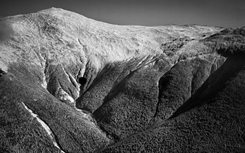
The Presidential Rail Trail between Whitefield and Gorham showcases the splendor of the northern Presidentials with Mount Washington’s summit towers in view.
 

Not what you want to see when youre starting a bicycle trip from the banks of the Connecticut River on the Vermont border, heading east on the 83-mile Cross New Hampshire Adventure Trail (xNHAT) to Bethel, ME.

So we donned multiple layers and gloves to start our late-May two-wheel overnight adventure on a collection of bumpy unpaved rail trails, dirt roads, bike paths and bucolic back roads across northern New Hampshires alpine splendor.

But my wife Jan and I knew wed remove that gear quickly as the MWOBS regional forecast was calling for highs around 70. Even better, thered be sunshine and a push from tailwinds out of the southwest at about 10 miles per hour.

Women on bike near pond viewpointJan was all smiles at the Pondicherry viewing platform.
 

Riding before 7 a.m. from the Nootka Lodge, morning dew glistened, a yellow finch checked us out and a rabbit paid us no mind as we pedaled along the Ammonoosuc Rail Trail and its namesake river.

Weve completed the trail twice before and thought it a fitting choice for the 21st Seek the Peak, given the stunning views of the northern Presidentials from the Presidential Rail Trail, the routes sparkling, scenic leg. The trail is loaded with rail lore and wildlife, as weve ridden the PRT countless times on day trips seeing moose, deer, bear, lupine and other wildflowers.

Marianne Borowski created the xNHAT trail. An avid cyclist, she pieced it together from her arsenal of day rides, and officially unveiled it with maps, cue sheets, planning tips, and website (xnhat.org) in 2019. Borowski and other cycling enthusiasts are leading day trips along the multi-use trail on July 16 and 17 as part of Seek the Peak, Mount Washington Observatory’s largest annual fundraiser supporting their work in weather and climate science.

Jan and I threw in new twists for this trip.

Instead of doing it in an unhurried three days, wed do it in two because Jan now owns a new pedal-assisted electric bike. Tired of me waiting for her and totally ticked off at walking up hills, the bike is a great equalizer. Her full-figured companion is named Zoe.

Bike on roads with mountains
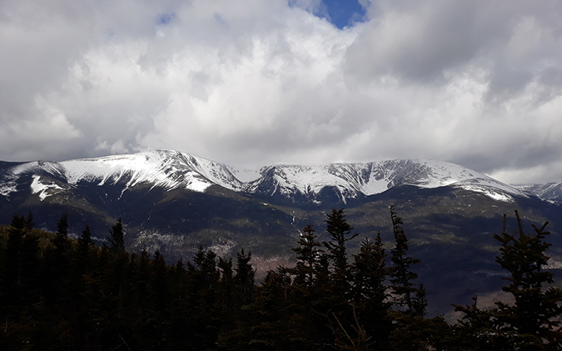
Jan and Zoe make their way along Israel River Road with its glorious scenery.
 

So the girls and I were off to a quick start with me on my trusted gravel bike. Jan and Zoe carried their essentials in two panniers including a charger, while I carried my necessities in my two saddlebags. We carried no camping gear as we hoped to overnight at Hub North in Gorham after a long 57-mile day.

Given how biking, hiking, paddling and more are now part of Seek the Peak, and all outdoor recreational pursuits are weather-dependent, we wanted to support MWOBS’ weather station—on the iconic rock pile—by cycling in the glow of the mountains impressive heritage.

That first day took us by small White Mountain towns like Bath, with its weathered covered bridge and The Brick Store containing a sweet selection of fudge. In Lisbon, we took a breather on the banks of the Ammonoosuc by its dam, as an angler plied the cold waters. Littleton, with its pedestrian covered bridge, old mills and shops like Littleton Bike and Fitness was the perfect place to shed layers and let the sun work its magic on pale legs.

Now the spotlight shone on Jan and Zoe. Outside of Littleton, the elevation rises sharply along Route 116 to Whitefield on a huge staggered hill that Jan has walked enough. Cycling behind me, she keenly waited until the slow travel lane emerged before rapidly pedaling past me with gloating laughter and a smile wider than Mount Washingtons shadow.

At the top, she waited for me. When I reached her, that smile was still there.

We descended into Whitefields Kings Square and sat outside the handsome gazebo eating some PB&Js before venturing into the grocery store for dinner items that included vital miniature boxes of cabernet.

Outside Whitefield, the scenery is striking. Wheel onto Airport Road and be wowed with that majestic alpine wall. Soon enough youre on the PRT through splendid Pondicherry Wildlife Refuge and notice the uptick in people—cyclists, walkers, birders—all bound for a wooden viewing platform with gorgeous Cherry Pond, Presidential and Pliny Range views.

This is the best part of the trip—the PRT, paved Israel River Road and dirt Valley Road (though it was freshly graded which made for some maddening soft sections). Unfortunately, young Zoe started mouthing off a bit. We finally figured it was some debris caught between her tire and fender. The odometer was also misbehaving, failing to record Jans total miles.

But that was behind us upon reaching Hub North (hubnorthnh.com), about a half-mile off the trail. Once a Girl Scout camp, its now a property with stylin’ lodge and yurt glamping convenient to mountain bikers, skiers and hikers. We unwound, plugged in Zoes battery and slept soundly knowing we had only 26 miles left.

Bike on roads with mountainsThe Cross New Hampshire Adventure Trail coincides with the white-blazed Appalachian Trail briefly on Hogan Road in Shelburne
 
With morning temps in the mid-40s, the Observatory forecast told of highs in the upper 70s and similar welcome tailwinds. That charged us up for another early start that included pedaling over a couple of bridges spanning Route 16 and the Androscoggin River. The trail keeps cyclists off busy Route 2 but that means navigating dirt Hogan Road with its rough and stony sections. We knew where to take it easy and where to travel at a brisk pace, eventually breathing easier as it reached its end by paved North Road where the bike route and white-blazed Appalachian Trail intersect. The famed Georgia-to-Maine footpath crosses the Mount Washington summit. Thankfully, the xNHAT does not.
Bike on roads with mountains
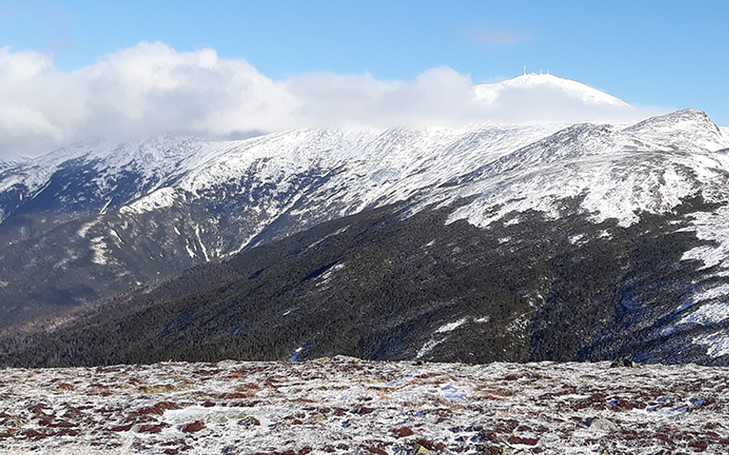
Marty crosses a bridge in Bethel, ME during the final stretch to the banks of the Androscoggin River in Davis Park.
 

North Road is a paved road paradise, a shaded roller coaster ride. Jan easily rode ahead, enjoying the forest and field landscape, which leads past under-the-radar hiking trails maintained by the Shelburne Trails Club, and into Maine with its Mahoosuc Land Trust trailheads, one with a radiant flower garden.

Then at a Bethel red fire hydrant, we turned onto a bike path for the final glorious mile to Davis Park along the banks of the Androscoggin.

When I got there, Jan was still beaming.


Marty Basch, Windswept Editor


Marty Basch and his wife Jan are Observatory members, donors and volunteers. Together, they’ve ridden the Great Divide Mountain Bike Route from Canada to Mexico and done a couple of silly spring skiing rides on a tandem pulling a cart with their alpine descending devices. Marty has completed several solo bike tours including cycling from Maine to Alaska, Maine to Georgia, New Brunswick, Canada to Newfoundland and Labrador, and riding near and above the Arctic Circle in Iceland, Norway, Sweden and Finland. An Explorers Club member, he’ll be leading a leisurely hour-long spin at Great Glen Trails during Seek the Peak on July 17. Jan and Marty can’t thank those enough who have donated to their 2021 Seek the Peak adventure along the xNHAT. They look forward to riding the trail together for a fourth time.


Marty Basch, Windswept Editor

From the Western Foothills of Maine to the White Mountains of New Hampshire

From the Western Foothills of Maine to the White Mountains of New Hampshire

2021-06-08 09:57:13.000 – Madeline DeGroot, Summit Intern


Hello from Mount Washington!

My name is Madeline DeGroot, but everyone calls me Maddie. I just graduated from Northern Vermont University – Lyndon with a B.S. in Atmospheric Sciences, Concentration in Private Industry, and a Minor in Mathematics. I am from the Western Foothills of Maine and attended Dirigo High School. I knew from an early age that I wanted to be a meteorologist, and now here I am, an intern at the Mount Washington Observatory!

For pretty much my whole life, I played softball, so I continued to play in college. I also enjoy hunting, four-wheeling, and spending summer days out on Androscoggin Lake in Wayne, Maine. My favorite place on earth is still a close family friend’s camp in Mattawamkeag, Maine, where I used to spend a few days to a week every summer. Fishing and kayaking are also a couple of my favorite activities. I’m not a huge fan of winter, although this past winter I began to venture outdoors in the snow more and more with the helpful nudge of my very outdoorsy boyfriend.

During my first week up here, I had plenty of time to acclimate myself to essentially being stranded on top of the tallest peak in the Northeast with several complete strangers and living with a cat. I’ve only once lived with a cat, as my roommate in college had one, but I only lived with her for just over a semester before COVID hit.

I was spoiled with 3 straight days of bright, sunny weather and above normal temperatures with minimal wind. The views were incredible, and I felt like the luckiest person in the world to have the opportunity to be surrounded by the beauty of the White Mountains and to stand on their highest peak. Over the weekend though, my luck ran out as the fog rolled in and temperatures dropped as the winds picked up. Not being able to see further than ten yards in front of me was an incredibly isolating feeling but being up here with other observers helped put me at ease. I’m now almost halfway through my second week up here and I’m still having a blast!

I am so grateful for this opportunity to live up here and learn about the important work of weather observers and the value of the forecasts provided by the Mount Washington Observatory. Everyone up here is amazing and they’ve all made it so easy to enjoy myself while still learning more about my career path. I’m really looking forward to what the rest of this summer holds for the home of the world’s worst weather!
 
Sunset at Mount Washington Sunset from my first shift as an Observatory Intern!


Madeline DeGroot, Summit Intern

Choose Your Adventure for Seek the Peak

Choose Your Adventure for Seek the Peak

2021-06-03 12:16:23.000 – Marty Basch, Windswept Editor


The venerable Seek the Peak is now a multi-sport expo complete with activities like hiking, rock climbing, mountain biking, paddling and more. The beloved event to benefit the science and research work of the Mount Washington Observatory on July 16-17 is now a chance to explore familiar or new pastimes within sight of Mount Washington.

Along with its generous partners and sponsors, Seek the Peak is a valuable opportunity to connect with trusted weather reports, trail information, and local tour operators loaded with knowledge. You can plan your own outing, take a guided option with an Observatory partner based on your STP fundraising level, or use a service of your own finding. The Observatory is even putting together a guidebook for participants.

Join presenting sponsors Great Glen Trails, Eastern Mountain Sports and Oboz on July 17 from noon to 7 p.m. at the foot of Mount Washington as Great Glen Trails Outdoor Center is transformed into a base camp that includes the Mount Washington Adventure Expo with a vendor village, live music and food trucks. Hear from experts from brands like Oboz and Petzl alongside nonprofits like the Access Fund and AbilityPlus.

Scratch hiking Mount Washington or another glorious peak from that bucket list. Or, go climbing or mountain biking. See landscapes from another perspective while paddling. DIY or hire a guide. Attend a clinic.

No matter what you choose, a safe experience starts with Observatory weather forecasts or a resource like North Conway radio station WMWV (93.5 FM).

Eastern Mountain Sports climbing school manager Keith Moon says the Observatory forecasts are an incredibly valuable resource for anyone recreating in the White Mountains.

“There is no better and more accurate product for 24 to 48 hour forecasts for Mount Washington and the surrounding valleys,” he said. “I personally check their forecast before every one of my personal and guided trips. We should count ourselves lucky to have the Observatory at the top of the highest mountain in our region.”

The valley is also lucky to have knowledgeable guides.

Great Glen Trails Outdoor Center events and marketing director Lisa McCoy says insight that a guide brings to outdoor adventure, from rock climbing to kayaking to biking, and even yoga, is invaluable.

“With their fingers on the pulse of activity, guides know the best places to go for specific conditions, and are trained to bring guests the best experience possible,” she said. “This summer, in partnership with the Observatory, we are offering our guided flat-water and whitewater kayak trips as a benefit to those who have raised money for Seek the Peak. It’s a win-win-win!”

Hiking is the backbone of STP. Planning is key. New Hampshire Fish and Game and the White Mountain National Forest have promoted the “hikeSafe Code” to encourage hikers and other backcountry travelers to enjoy their adventures smartly and responsibly.

Even by carrying hiking essentials and being smart by turning back in foul weather and the like, trouble happens. That’s where Fish and Game’s hikeSafe card comes in. Think of it as backcountry insurance with proceeds benefitting the department’s search and rescue fund.

Gladys Brooks Memorial Library Curator Peter Crane, an avid hiker and president of the New Hampshire Outdoor Council, says responsibility for wilderness search and rescue (SAR) in the Granite State belongs to the New Hampshire Fish and Game Department, with some involvement also by other state or federal agencies, such as New Hampshire State Parks and the U.S. Forest Service or the New Hampshire Army National Guard.

“These paid professionals are assisted by many unpaid professionals, volunteer members of the several search and rescue teams that serve hikers, climbers, and others in need of emergency help in the state’s mountains and forests,” he said.

Sometimes Observatory staff serve as SAR members. Though no such service is part of the Observatory’s standard mission of weather observation, research, and education, Crane says it is part of being a good neighbor on Mount Washington. When accidents occur near the summit, it’s not unusual for Observatory staff and interns to work with State Park personnel and others in providing a timely response. The snowcat may be used to help in winter too.

“Over the years, several Observatory staff have also joined local SAR teams, so that on their ‘off time’ they are on call to assist in SAR activities, extending the value of lessons they have learned while working at the summit,” he said.

So, what will you do?

Seek your own peak during Seek the Peak like participant Ashley Witham. 

Hiking

Crane has a few suggestions for hikes other than Mount Washington like a short trip on the Lost Pond Trail and Square Ledge Trail up Square Notch in Pinkham Notch across from the Appalachian Mountain Club Visitor Center on Route 16. Though there’s a quick scramble, the view of the eastern face of Mount Washington is awesome.

A 6.2-mile Raymond Path loop through the mountain’s forested lower slopes also from the visitor center serves up more of a challenge. Use the wide and rocky Tuckerman Trail before taking a right on the Raymond Path, one of the oldest trails on the mountain that was once a bridle path. Then take Old Jackson Road back.

For a challenge, consider the 10.2-mile lollipop loop to Carter Dome, one of the top ten highest in the state. Start with the 19 Mile Brook Trail, about a mile north of the Glen House on Route 16 and then use Carter Moriah Trail, Carter Dome Trail with its switchbacks and 19-Mile Brook again.

North Conway’s climbing ledges are ideal locations to go rock climbing (EMS Photo). 


Rock Climbing

They don’t call New Hampshire the Granite State for nothing and North Conway’s highly visible and massive White Horse and Cathedral Ledges just outside the village have attracted rock climbers for almost 100 years scaling the cliffs more than 500 feet tall. Between the two cliffs there are more than 300 established routes from easy to expert. North Conway has a number of climbing schools.

“The high quality of rock, large variety of route levels and incredibly easy access make these two cliffs classic destinations,” said Moon.

Routes like Standard and Inferno on White Horse and Thin Air and Recompense on Cathedral are well known.

Moon says climbing is a sport where you can start at any age and it’s not uncommon to see climbers well into their 70s.

“We will be offering programming for folks who have been interested in climbing and just want to check it out, to private trips for climbers looking to get on a dream route, polish their skills or become better prepared for self-rescue scenarios,” he said.

EMS, along with other schools, will host a climb and rappel station at Square Ledge in Pinkham Notch.

Mount Washington makes for a dramatic backdrop during a rock climbing adventure (EMS Photo). 

With Great Glen Trails Outdoor Center as your guide, paddle along the Ammonoosuc River (Great Glen Trails Outdoor Center Photo). 


Paddling

The plentiful rivers and lakes of the Mount Washington Valley and its surroundings are prime places to paddle surrounded by nature’s bounty.

The Saco River is popular, perhaps overly so, with an easy stretch a short drive from the Observatory’s Administration Offices. Paddle eight miles from First Bridge on River Road in North Conway to Davis Park with its covered bridges.

The experience is heavily dependent on water levels. Local shuttle services and kayak and canoe rentals are available; two vehicles are helpful.

Conway Lake with its Mill Street access is a fine alternative, about eight miles from North Conway.

“Conway Lake is always good for a four-hour paddle,” says Great Glen Trails Outdoor Center program director Nate Harvey. “It’s easy, unless there are huge winds, and pays out big time with swimming and loon sightings.”

For a more secluded paddle travel north from the Great Glen Trails Outdoor Center to the Androscoggin River where osprey and eagle spotting could prove positive. It’s about a 3 or 4-hour float just over the Maine border from Gilead to Bethel. Two cars or shuttle are necessary. Great Glen offers both half-day and full-day guided wildlife kayak tours of that stretch, as well as whitewater kayak clinics on its summer recreational menu.

Ride along with the family at Great Glen Trails Outdoor Center (Great Glen Trails Outdoor Center Photo). 


Biking

Mountain biking is enjoying a knobby-tired renaissance with North Conway seeing a multitude of new trails and local spirit. Both the long-standing White Mountains Chapter of the New England Mountain Bike Association and new White Mountain Bike Coalition are instrumental in trail development and maintenance. Download the Trailforks app and choose your ride. One pod loaded with sinuous singletrack for all abilities is the Marshall Conservation Area on West Side Road, a short drive from North Conway. Downhillers like the growing trail grid off Hurricane Mountain Road.

Looking to try lift-served mountain biking? The Cranmore Bike Park opened last summer and offers rentals and lessons.

Another mountain bike club spreading the gospel of dirt is the Gorham-based Coos Cycling Club which oversees a growing network including those found in Moose Brook State Park. Last year the club surprised former Observatory trustee Howie Wemyss after he retired from his role at the Mt. Washington Auto Road and Great Glen Trails by naming an intermediate/advanced trail after him with a play on his name—Howie Roll.

Great Glen Trails is also a mountain biking hub, offering miles of wide carriage roads and narrow singletrack for all skill levels. With a base lodge and rental shop, grab a map before heading out on the well-signed network.

“The cool thing we have at Great Glen is vistas, streams to put your feet in, wildflowers everywhere and pedal-assist e-bikes,” said Harvey. “Biking at Great Glen is also cool for the family.”

Bicycle travelers can ride the Cross New Hampshire Adventure Trail, a 83-mile long collection of northern New Hampshire paved and dirt back roads and rail trails between Woodsville, N.H. and Bethel, Maine. In the shadows of Mount Washington, the xNHAT is used by a variety of outdoor lovers including bicyclists, hikers and runners. The trail passes through small towns and has an ample supply of lodging opportunities from camping to inns, restaurants and grocery stores.

Hardcore cyclists can do it in a day, but more leisurely bicyclists carrying their own gear tend to do it in three days and two nights, and can even get a patch upon completing the whole trail.

Trail founder Marianne Borowski and volunteers will lead guided rides along pieces of the route during STP. One easy and scenic out-and-back 8-mile ride is to the Pondicherry Wildlife Refuge along the Presidential Rail Trail. Another is a moderate 21-mile out-and-back ride on rolling back roads and the PRT.

No matter your choice for STP, you’ve made the right one.

This article also appears in the Summer 2021 edition of Windswept: The Bulletin of the Non-Profit Mount Washington Observatory. For more information, visit our Premium Content page. Windswept Editor Marty Basch and his wife Jan have twice bicycled the entire Cross New Hampshire Adventure Trail and plan to do it again for Seek the Peak. Marty is also leading a leisurely hour-long spin at Great Glen Trails during STP on July 17. To register, start raising funds, or support a participant, visit seekthepeak.org.


Marty Basch, Windswept Editor

Mountain Life Quirkiness

Mountain Life Quirkiness

2021-06-01 09:27:42.000 – Michael Brown, Summit Intern


What’s up! My name is Michael Brown, and I am one of the many interns working at the Mount Washington Observatory this summer. While I am a life-long New England resident from Shelton, Connecticut, and no stranger to the cold, Mount Washington truly lives up to its phrase of the home of the world’s worst weather! I am a rising second-year meteorology major at North Carolina State University, with a special love for extreme weather. Some of my personal hobbies include biking, playing sports (especially volleyball), and storm chasing.

After my first visit to the summit some years ago, I always dreamed of working in the observatory, and am thrilled to have this opportunity! The extreme weather of the summit and the spectacular views from the observatory piqued my interest, and I look forward to experiencing first-hand the wild winds and wacky weather conditions the summit is known for.

During my short time on the summit so far, I have learned quite a lot. Having only had a little education in meteorology so far, I was a little worried that I would be well behind in my knowledge, but that has simply not been the case! I quickly became acquainted with many observatory duties, including taking hourly temperature observations, determining cloud layer heights, and determining visibility using local geography. In my off time so far, I have enjoyed watching sunsets, exploring the summit with the other intern on my shift, A.J., and chatting with the day and night observers. I am very excited to greet visitors to the summit museum in the next few weeks, and I look forward to the projects that lie ahead in this internship!


On my first night here, I was welcomed into the position by an amazing sunset in the mountains. As the sun journeyed below the mountain peaks in the distance, a truly spectacular view of backlit clouds and virga (precipitation that does not reach the ground) appeared to the west. I can’t wait to view more sunsets, and perhaps some early sunrises, during my time working here at the Mount Washington Observatory!


Michael Brown, Summit Intern

Go to Top