Temperature:      Wind Speed:      Gust:      Wind Chill:      Direction:    Switch to Metric

October 2018

Back from Vacation

Back from Vacation

2018-10-01 09:32:24.000 – Adam Gill, Weather Observer/IT Specialist


This is my first week back from vacation and we finally got a bit of winter weather! I was hoping for more in the way of snow but getting a bit of rime ice was good enough. I strategically tool the vacation in September when the last of the summer weather is still around and the cold weather is staying just too far to the north.

While on vacation, I was able to get back home to Colorado for a bit as well as visit a few friends that I graduated college with up in Minnesota. I finally got to go to the Great Sand Dune National Park even though I lived in Colorado for most of my life. It was awe inspiring seeing sand dune that large. I was able to make it to the top of one of the sand dunes, which was as hard as you would imagine. It would be a good work out to prepare for hikes!

Sand Dunes National Park Great Sand Dunes National Park in Mid September

When I got back to New Hampshire, I participate as the best man in former Observer, Mike Carmon’s wedding. It took place in Sugar Hill with a good view of Mt. Lafayette and part of the Presidential Range. It was a really great wedding to be part of! There was a spectacular sunset at the end of the wedding ceremony that really made the sky light up with colors. Congratulations to the newlyweds Mike and Jess!

 Mike and Jesse's First LookMike and Jesse just after first look
 
Sunset after Mike and Jesse's Wedding Sunset after Mike and Jesse’s wedding during the Reception

I was pretty jealous to see that the other shift were the first ones to see winds over 100 mph for the winter season, but this also means that more exciting weather is not too far off! Initially at the beginning of this week, it looked like there could have been another chance at seeing 100+ mph winds but time got closer, the storm has gotten weaker and further to the north. 

Sunset with Tessa and Zach Taking Pictures 
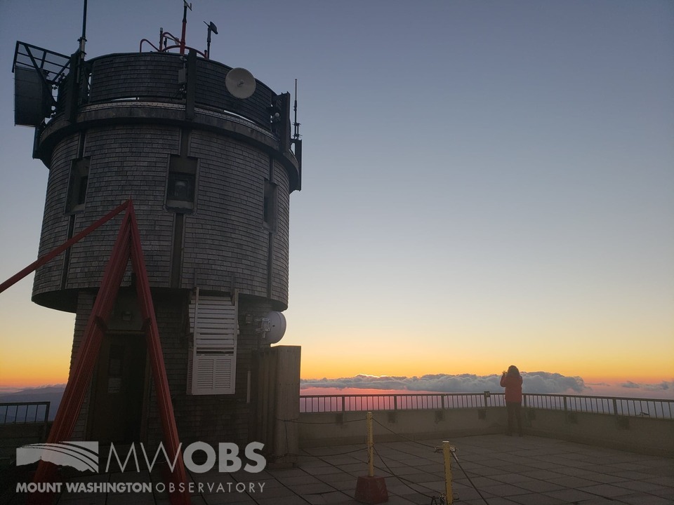
Sunset from a few days ago with Tessa and Zach taking pictures. This was just before we started riming and the temperature had just fallen below freezing

Looking ahead, it is looking like another ridge will be building into the eastern half of the US which will keep the above normal temperatures continuing, while places out west could see a decent amount of snow. I think that the really warm and humid weather is done for the season across the White Mountains but still getting up into the 80’s will still be possible in the valleys. We could even make a run for the upper 50s again on the summit later this week.


Adam Gill, Weather Observer/IT Specialist

September 2018

High Winds and Icy Sunsets

High Winds and Icy Sunsets

2018-09-25 16:37:42.000 – Chloe Boehm, Summit Intern


The last few days up here on the summit have given me my first real taste of the extreme (and beautiful) weather that Mt. Washington. Within 5 days of breaking a daily record high temperature, we had our first significant icing event of the season and our fastest wind speeds since May! Although the summit starts to get frost and some ice fairly regularly this time of year, the elements really aligned this past weekend to give us some of the most extreme weather I have ever seen.

My week up here on the summit started out beautiful and calm with a strong cloud inversion that made driving up the auto road Wednesday a pretty amazing experience. We started out with a sprinkle of rain in the auto road parking lot and completely overcast skies but as we climbed up over 5000 ft, we suddenly broke out of the clouds to see beautiful sunny skies ahead. For once, the summit actually had more favorable weather than the valleys did! As much as I like sunny skies and low winds, I was much more excited for what was going to happen in the next few days.


On Friday into Saturday, two strong fronts passed through the region, first a warm front that gave us some pretty significant rain showers that then was followed closely by a strong cold front. Since these two fronts were fairly close together, there was a very steep pressure gradient between them. The phrase “pressure gradient” is often used to explain why we get such strong winds so I wanted to take a second and explain what it was. For those who don’t know, a pressure gradient is essentially the rate at which the pressure changes over a certain distance. A steep pressure gradient would mean that the pressure was changing a lot over a short distance versus a weak pressure gradient would mean that the pressure was not changing very much or that it was changing but over a very large distance. Since wind moves from areas of high pressure to areas of low pressure, the steepness of the pressure gradient directly correlates with the speed of the wind. If you think of the wind moving across the pressure gradient like a ball rolling down a hill it can help one visualize what is happening. The steeper the hill the faster the ball rolls and similarly the steeper the pressure gradient, the faster the wind speeds. So when observers see how the pressure gradient is changing it can give a pretty good idea of how the wind speeds are going to change.

The pressure gradient we saw last Friday and Saturday was very steep, so steep in fact that wind speeds were sustained at 70-80 mph and we saw gusts up to 108 mph. This is some of the fastest wind speeds in September the summit has seen in a while! Combined with those fast winds was cold temperatures from the incoming cold front which created a wind chill well below freezing. That plus the fact the summits was in the clouds and there was quite a bit of moisture in the air created prime conditions for icing. On Saturday morning, we saw a few inches of ice on most of the parapet and on the railings of the observation deck.

The ice managed to stick around till sunset which made the beautiful sunset even more beautiful. Needless to say, this past weekend made me even more excited for the upcoming winter. Thanks for reading, and I will leave you with some pictures of the gorgeous sunset we had on Saturday night.


Chloe Boehm, Summit Intern

The Night Sky On The Summit, And ‘What We Do For Fun’

The Night Sky On The Summit, And ‘What We Do For Fun’

2018-09-18 05:28:45.000 – Christopher Hohman, Weather Observer/Staff Meteorologist


Hello everyone!

What a beautiful week of weather we’ve had here on the summit. That is, if you think clear conditions constitute ‘beautiful conditions.’ Personally I love being in the clouds, with high velocity winds whipping around the summit. Regardless though, we had a lot of sun this week, and subsequently very warm temperatures. We tied and broke daily record highs on two days, which was something we were thinking, might happen during our weekly Wednesday shift changes. Overall I’m happy with the weather we got to see this shift, but I’m definitely ready for the snow and fast winds coming within the next few weeks!

I thought I would spend this blog going a little more in depth on a few questions we got during some of our facebook live events. One of them really intrigued me: “Besides the weather, what kind of things do you get to see at night? How dark is the sky?”

The night sky here is easily the darkest I have ever experienced in my life. I’ve been to Cherry Springs State park in Pennsylvania, and the night just doesn’t get as dark as up here. For those of you who don’t know what that place is, it is a state park that is notorious for having some of the darkest night skies in the United States. This photo is exaggerated, Zach used a 15-second exposure to capture it, however this will give you an idea how dark the sky can get (That’s me by the way): 


I normally see at least one shooting star if we’re in the clear, and there is no moon. If you stand out there for five minutes, I would say you’re almost guaranteed to see a shooter. The whole shift stargazed earlier in the week for about 20 minutes, and we probably saw around 5-10 shooting stars. One of them was so bright we were sure it was going to be on the news, but alas, it sadly was not.

The most interesting part of the night to me though, is watching the constellations rise and set at different times throughout my shifts. When most people look into the night sky, it’s only for a few minutes about an hour or so after the sun goes down. Me though, I watch the entire night sky move and change from sunrise to sunset. You really start to notice a lot when you do that every hour for an entire week. I knew a decent amount of constellations when I started this job, but there have been countless times where I think to myself, “Those grouping of stars look kind of bright and form an interesting shape, I be that’s a constellation.” I’ll head inside to check, and sure enough 9 times out of 10 I found some random constellation I never knew existed. For example I was admiring Orion (Yes, the classic winter constellation is rising at around 4:00 a.m. right now. Winter is coming folks…) and noticed a grouping of stars to the left of him. I present to you, Monoceros:


Another question asked was, “What do you guys do for fun up there?” When I first heard this question, I was actually slightly surprised. We aren’t normally asked that; I mean most of the questions we get revolve around our jobs or Marty (Mostly Marty). Relaxing after a shift is incredibly important. We’re always keeping our eyes on the weather, and doing everything we can to produce to best observations. Therefore, decompressing after 12 hours of constant work is big for us up here. We don’t get that much of it, we normally only have 2-3 hours of true down time on any given day.

A popular thing to do amongst shifts is to watch TV on the various streaming services we have up here (Classic Netflix, Hulu). If the weather is nice, sometimes one of us will go for a quick hike. Some of our favorites are heading to Clay, or taking a walk to the Alpine Garden.

On our shift, we always try to play some kind of board game with one another. Ian has literally HUNDREDS of board games at his house. He used to work at a board game café! Seriously, if you have some obscure board game that no one knows about, chances are Ian’s played it a million times. He graciously brings a few games up from his own collection just about every week for us to try out. This week we played a lot of “Ticket To Ride.” Pretty fun. Definitely worth the money if you ever see it at a toy store…

Last night we took a break from the games and had a paint night lead by our Museum Attendant Tessa! She had us try our hand at painting her own original: a painting of Marty, with Mount Washington and the Observatory in the background. Check out how amazing Tessa’s came out!


Thank you so much for reading my blog! Hope you found it fun and informative. Feel free to message us if you have any questions on anything mentioned above. Thanks again, and have a wonderful day!


Christopher Hohman, Weather Observer/Staff Meteorologist

Record Breaking Temperatures

Record Breaking Temperatures

2018-09-17 12:57:41.000 – Zach Butler, Summit Intern


As I typed this, we were breaking a daily record high temperature on Mount Washington! The temperature was 62 degrees, which broke the record for the 15th all the way back to 1939 when they recorded a temperature of 61. What lead up to these warm temperatures the other day and back in 1939? How do the days compare to each other? I went to the weather maps and history books to find out.

The weather pattern for New England was a large upper level ridge with a strong surface high pressure that had been stationary the last several days. This high pressure brought extremely nice weather to the higher summits with few clouds, little to no wind, and warm temperatures.


From this surface map, you can see the surface high pressure centered over New England. The main weather event was Tropical Storm Florence in the Carolina’s. This strong high pressure is part of the reason Florence had been slowly moving down West.

The most remarkable aspect about the high pressure over the White Mountains was the weak pressure gradient causing very light winds atop Mount Washington. The 3 days before the record break had observed wind speeds of less than 20 mph during the day, even being calm at times. While this can happen atop the summit, it is rare to see these low wind speeds for such a long and consistent duration. These weak wind speeds allowed temperatures to warm on the summit significantly. Usually, wind is able to reduce temperatures by literally blowing them off the summit. But with these calm winds, the warm temperatures were sticking right on the summit, allowing us to hit 62. The day before, we actually tied the daily record high of 60 back in 1993 and 2017.

So, did the weather patterns that day consist of similar conditions back in 1939 with the previous record of 61? I went back to the Observatory’s log books to compare the days. Below you see an image of the hand written log from September 15th, 1939.


Wow, what a difference in days! From observations on Septemebr 15th, 1939; the summit was in the clouds for most of the day with sustained westerly winds from 20-40 mph. After 12pm however, they broke out of the clouds. By 3pm, the sky cover was only a 2, which means there were only a few clouds in the sky. This break in the clouds allowed the temperature to increase to previous record of 61 degrees.

With partial clouds, the temperature stayed between 60 and 61 degrees until evening. This clearing in the clouds decreased winds slightly, in the range of the 20-35 mph. Despite the winds and clouds in the sky, temperatures were able to warm to 61 degrees.

This is a quite a difference in weather conditions compared to 2 days ago, with little to no clouds and wind. While there are no archived surface maps to see what kind of air mass was over the region in 1939, they did record the pressure in the log books. 24.118 inches of mercury was recorded on the summit that day. 2 days ago the barometric pressure was at 24.136 in hg. These two pressure readings are fairly similar. Therefore, back in 1939, there was likely a high pressure system over the summit. This high pressure system was likely associated with more moisture, causing more clouds on the summit. This could have been combined with a tighter pressure gradient in the high pressure back in 1939, that would lead to faster wind speeds compared to the other day.

This short analysis shows the differences of weather conditions that can lead to warm temperatures. It was very interesting to check out some of the Observatory’s old weather observations to compare to the 15ths record breaking readings!


Zach Butler, Summit Intern

Sunny Skies and Happy Times

Sunny Skies and Happy Times

2018-09-15 12:26:05.000 – Ian Bailey, Weather Observer/Education Specialist


Transitioning from the summer to the fall has certainly been keeping us busy up here at the summit. And with Shift Leader Adam gone this week on vacation, things have been even busier than usual. But as I promised myself during my internship, I’ve made sure that I am never too busy to stop, look outside and enjoy the weather that is happening around me. And in doing so over the last few days, I’ve seen some pretty beautiful sights.

We’ve been under a strong high pressure system since we arrived on Wednesday. Starting Thursday morning and through the time of this publication, the skies have been a clear, vibrant blue. It is the polar opposite of the intense, extreme weather that we are used to living in up here. That’s what makes this place so special! Crazy wind speeds, frigid temperatures, heavy precipitation and storms are usually the conditions we are excited for when we are at work. But that doesn’t mean those are the only conditions that we like or the only conditions that make the mountain as special as it is.

High pressure systems such as this one generally bring drier air, reduced wind speeds and warmer temperatures to the region. And this system is no exception. But it’s not often that these conditions are as intense as they have been so far this shift. For the first time since our return, Night Observer Chris and I have both recorded “Clear Skies” observations, indicating that we are not observing any clouds above the summit at all! Usually there are some puffy cumulus or light bands of stratocumulus clouds. But for several significantly long observation periods, there was none of that at all!

And these wind speeds! Sure, we get calm winds less than 20, sometimes even less than 10 mph. But rarely ever do we get 1 or 0 mph winds! And today, we’ve had 1 mph winds several times. The air is crazy still outside!

Arguably most important is the temperature profiles associated with these conditions. It is much warmer than average for this time of year at the summit. We tied yesterday’s high temperature record of 60 degrees, and today we could tie or break the 61 degree record! It’s incredibly warm! And so even though we don’t have hurricane force winds, blinding snow storms and frigid temps, we are still excited to be experiencing the weather that we are and it is special to us!

And so we definitely take the chances we can to enjoy everything the calm weather has to offer!


Take, for example, this wonderful sunrise that we had Thursday morning! Intern Zach ran outside to catch this as the sun was cresting over the residual cloud layer. These were the last significant cloud decks that we had since we arrived, and Zach managed to catch the light shining through in such a perfect way! You can see how clear and blue the sky above is, and you can even see the stable layer marked by the tops of the low clouds spreading out across the horizon! It certainly made for a nice wake-up call!
  

And oh man, how about this night sky?! I’ve been kicking myself for missing the last clear night sky we had up here. So I made sure to be on top of this during this high pressure. You could see the Milky Way clearly, without needing the help of a camera at all. The moon was shining bright to the Northwest, and we saw several shooting stars! There was 1 insane shooter than blasted across the Northeastern sky around 9:00 pm. It streaked bright green before turning a vibrant light blue. And at the tail end of its descent (after a solid 6 or 7 seconds of falling) you could even see sparks and fire flaking off of it as it flashed a bright orange before disappearing below the horizon.


Sunset yesterday evening has been one of my favorites so far this year. 99% of the sky was clear around us, which lead to beautiful rainbow colors across the horizon. But that remaining 1% came in the form of 1, tiny little cloud bank, that decided to situate itself perfectly between us and the setting sun to the Northwest. So the clouds had a golden lace to their outline, with a sharp gray contrast that was just breathtaking. So, while we were out enjoying the beautiful view, we took the opportunity to make use of a very generous gift we just received!

Larry and Donna Martin had approached us during Seek the Peak back in July and had witnessed the conditions of our previous bag toss boards. So they took it upon themselves to craft us a brand new set! They are solid wood and incredibly durable, painted with beautiful MWObs colors and an awesome decal of the Obs Tower! And the bags are very well crafted also, not bouncing or sliding too much on the boards at all. It was very thoughtful of them and we really do appreciate the donation! So thank you so much if you are reading this! We had a very close first game as we enjoyed the incredible sunset, and ended with a final score of 21 to 17 after “yours truly” sunk 1 in the hole and 1 on the board!

So it just goes to show that the “extreme” Mount Washington weather can be exciting. But we also truly enjoy the quiet times. We get wonderful conditions, breath taking views, and can enjoy the observation deck and our time with our crew comfortably. It looks like today and tomorrow will be more of the same weather, so you can bet I will continue to take it all in and enjoy it as much as I can!


Ian Bailey, Weather Observer/Education Specialist

Mount Washington: Breaker of Storms

Mount Washington: Breaker of Storms

2018-09-08 09:27:36.000 – Sarah Schulte, Museum Attendant


        Each season brings with it new meteorological wonders for weather nerds to anticipate, and summer is certainly no exception. While the winters on Mount Washington are great for rime ice events, torrential snowfall and fierce winds, the summer season is a prime time for thunderstorms. Whenever the potential for a nice line of cells crops up in the models, everyone begins to cross their fingers in anticipation for a natural light show…

…only to have their shoulders slump in disappointment when the cells sputter and die upon approach of the mountain. The weather is taunting us!

Unfortunately, this aggravating behavior can’t be blamed on Mother Nature’s malevolence. Mount Washington has a tendency to either make or break a thunderstorm, and in either case, the thunderstorm isn’t usually happening directly at the summit. This isn’t to say that we never see a storm at the summit; as the tallest metal object around, our tower and deck make an attractive lightning rod. In fact, thunderstorms are the only conditions in which the weather observers won’t venture outside for their hourly observations. However, this does mean that getting extremely hopeful at the sight of every approaching system can be a good setup for disappointment.

So, why does Mount Washington have this power?

Making (and Breaking) a Thunderstorm

Mount Washington isn’t special when it comes to generating and destroying storms. The cause of thunderstorm formation at the approach of a mountain is orographic lifting. Orographic lifting is the ascent of an air parcel due to terrain. As air is pushed up against the side of the mountain, it’s forced to rise. The air parcel cools as it rises, which means a moisture-laden air parcel will condense and create precipitation. In the case of Mount Washington, the elevation is high enough that the storms are often drained of energy by the time they reach the summit. Thunderstorms essentially get wrung out like sponges as they climb mountains (just like people!), and while they might still have precipitation to give when they crest, they tend to lack the energy necessary to light things up like they did upon approach.


Some taller mountain ranges, such as the Rockies in the Western US or the Himalayas in Asia, drain clouds to the point where their precipitation reserves are completely spent by the time they reach the peaks. When this happens, the mountain range can create a rain shadow, which is a dry region to the east of the peaks. Because the mountains inhibit the passage of clouds, the areas to the east receive very little rain, hence the many deserts to the east of the Rockies and the Tibetan Plateau east and north of the Himalayan Mountains.

This thunderstorm making/breaking ability is another reason why checking the weather before a hike is very important. One of the ingredients of a thunderstorm recipe is warm, rising air, and in the summertime, the White Mountains absorb enough heat and cause enough lifting on their windward sides to brew up some dangerous weather. And since the elevation of the White Mountains isn’t staggering, these storms won’t necessarily peter out as they crest, especially on some of the lower slopes.

For the weather nerds working up here, this phenomenon can lead to some incredible sights, such as an afternoon several weeks ago where the summit was in the clear, and there were thunderstorms brewing all around us. On the other hand, it can also lead to very anticlimactic storm events, or frustrating moments when the cell reorganizes after it passes over the mountain. As of now, I still haven’t learned my lesson, and I know I’ll continue to get excited whenever the possibility of a good show rises up our windward slope!


Sarah Schulte, Museum Attendant

Squall vs. Microburst: What’s the Difference?

Squall vs. Microburst: What’s the Difference?

2018-09-07 11:10:13.000 – Thomas Padham, Weather Observer/Education Specialist


Earlier today I received a weather question which I thought would make for a great blog post. What’s the difference between a squall and a microburst?

A squall sort of has two meanings, the meteorological definition (which we use for our reporting) and the term used by everyday people. The National Weather Service definition of a squall is: “A strong wind characterized by an increase in wind speed of at least 16 knots and sustained at 22 knots or greater for more than a minute”. As you can see that’s quite specific, and something we rarely report from the summit since we actually see conditions meeting this definition very often. We use our discretion as to whether the increase in wind is operationally significant, and also have the option of reporting a “peak gust” in our hourly observations for winds under 100 mph, with a mandatory peak gust reported for all winds over 100 mph.

 
 A squall line of thunderstorms on radar moving across the Midwest. Image courtesy of the National Weather Service.

To most people, a squall (or squall line) is a heavy band of showers, possibly containing rain or snow. The band may also be accompanied by lightning, and is always accompanied by suddenly strong and gusty winds as the NWS definition states. Personally, I tend to think of the term “snow squall” which can occur during the winter here in the Northeast typically with an arctic cold front. These have heavy, but usually brief snow along with gusty winds and create whiteout conditions and hazardous travel.

 
A shelf cloud is often visible at the leading edge of a squall, as in the case of this thunderstorm over the Canadian Plains. Image courtesy of NASA. 

A microburst has similar weather conditions to that of a squall, and may actually occur within a squall line from thunderstorms. A microburst is a sudden and rapid increase in wind speed from rain cooled air within or around a thunderstorm. This mass of colder air descends from a thunderstorm, picking up speed and spreading out as it hits the ground. This can occur over a small and localized area, hence the prefix micro. If conditions are right these downdrafts of higher winds can occur over much larger areas, and are typically referred to as a “macroburst”. Long-lived damaging wind storms, crossing several hundred miles and lasting for many hours are called derechos.

 
A microburst as seen on our Hays Wind Chart from June 9th, 2004. Winds rapidly increased to a peak of 122 mph over just a few minutes before falling back off to 60 mph behind the storm. 

A microburst can sometimes see wind speeds in excess of 100 mph, with similar damage to that of a tornado. The damage will actually look different from that of a tornado in that the wind pattern spreads out over an area (similar to dumping a bucket of water onto the ground) vs. a tornado will have a rotating wind/damage pattern.


Thomas Padham, Weather Observer/Education Specialist

Education Time from you to me to the AMC!

Education Time from you to me to the AMC!

2018-09-02 17:06:16.000 – Zach Butler, Summit Intern


I have always been passionate about the education around meteorology. The science affects people’s lives every day, every hour, and every minute. The importance of educating the public on this science is vital for communities to understand the dangers and aesthetic around meteorology.

Every day, we at the Mount Washington Observatory, radio our morning weather conditions and 48hr forecast to the Appalachian Mountain Club (AMC) huts and shelters. The staff writes and posts are forecasts for themselves and people traveling through to see and take note. The importance of these forecasts are vital for the outdoor community in the White Mountains to understand the weather conditions they will be facing. As an AMC member on a trail crew the past two summers, I have a personal relationship and communication within the AMC. Friends and family have always asked me about the weather in all forms of questions. The biggest impact I took from these interactions was what are all these terms you use? These “terms” were common knowledge to me as a meteorologist. However, many people did not understand these definitions or terms we as meteorologists use.

As an intern on Mount Washington this summer and now through the fall, I have taken even more interest in the education surrounding meteorology. This last week, I have begun to develop a glossary of common meteorologist terms we use at the observatory in our forecasts. The goal is to share this information with the AMC to help them and the outdoor community understand what the heck us meteorologists are actually saying. This glossary is 2 pages and has several diagrams that explain and describe common weather terms and physics. I’ll comment some examples of meteorology terms that I have written into this glossary:

Relative Humidity (RH) – amount of moisture in the atmosphere that is dependent on the temperature. Used in a percent (%)

Barometric Pressure – the weight of the atmosphere, measured in inches of mercury (Hg) or millibars (mb)

Rising pressure – clearer weather on the way!

Falling pressure – unsettled weather on the way!

Pressure gradient – the decrease in pressure per unit of horizontal distance

Tight gradient – associated with low pressure and higher winds

Loose gradient – associated with high pressure and weaker winds

Jet Stream – atmospheric river of higher winds that steers all weather systems. Can occur at multiple levels in the atmosphere (low-level, mid-level, upper level jet. See level’s below)

*These are simplified diagrams. Real scenarios are often different, but this gives a good idea of what they look like!

Trough – A horseshoe area of lower pressure created by the jet stream

Ridge – An upside down horseshoe area of higher pressure created by the jet stream

Long Wave Trough – a pressure trough characterized by large length and usually long duration

Short Wave Trough – a pressure trough characterized by small length and a shorter duration. Often leads to upward motion and lift ahead of it

What makes a thunderstorm?

Instability (Unstable) – the tendency for air parcels to accelerate from their original position (usually upwards!)

Moisture – water vapor content in the atmosphere. Need high dew points or high RH

Lift – the vertical movement of air or a fluid

Convection – vertical transport of heat and moisture by movement of a fluid (air)

Hail – ice particles observed from some thunderstorms. Only occurs in summer!

Sleet – not in a thunderstorm! Ice particles observed when the surface is below freezing

Levels of the atmosphere:

Low-levels – lowest 700mb of the atmosphere

Mid-levels – between 700mb and 500mb

Upper-levels – 500mb and higher of the atmosphere

Other Terminology:

Diurnal Variability – variability of any variable (temperature) from day to day or night

Subsidence – a descending motion of air in the atmosphere

Stable – lack of vertical motion. Warm air above cold air inhibiting vertical movement

Inversion – temperature increases with height

Heat index – how hot it really feels when the RH is added to the temperature

How do the mountains make or create weather?

Upslope or Topographic lift – air is forced upward and creates clouds or precipitation; dependent on wind direction Lapse Rate – temperature decreases with height on average 3-5 degrees F with every 1000ft. The drier the air, the cooler air colder as you increase height

*This is highly variable (Dependent on moisture in the air)

This is what I’ve developed this week, minus the diagrams. These terms were developed based on what we use in our current summit conditions, as well as our forecast discussions. I hope these terms are understandable and relate some of the science of meteorology to understandable terms. Well that’s all the time I got, I’ll sign off with a beautiful sunset we had this week on the summit. Have a great day!


Zach Butler, Summit Intern

August 2018

Farewell Mount Washington!

Farewell Mount Washington!

2018-08-28 09:51:05.000 – Griffin Mooers, Summit Intern


As my summer internship comes to a close I want to take the opportunity to thank the Mount Washington Observatory a great last few months. Growing up in New Hampshire and obsessed with weather since childhood, it’s long been an aspiration of mine to spend time at the summit with at the observatory. So I was beyond thrilled when I was told this past spring I would get to be a summit intern this summer. The experience has not disappointed. I expected the weather to be interesting, but I was blown away (pun intended) by the most exciting conditions I’ve ever seen in my life. I was fortunate enough to be outside in a 91 mph wind gust. The double rainbow our shift came across on the Auto Road was by far the nicest I’ve ever seen. I experienced my first June snow. In a glaze event, I watched as the summit got coated with almost an inch of ice earlier this summer.


There were also things about the summit I didn’t expect to experience, but quickly became some of my favorite parts of the summer. It’s simply amazing to be able to just look out a window in New Hampshire on a clear day and see the Adirondacks in New York. The sunsets on the summit are truly the most amazing I’ve ever seen and always a shift highlight. I was even fortunate enough to see the Auroras this week. I also really enjoyed the chance to get to meet two new volunteers each shift. It was great to get to know so many interesting people and the wonderful meals they provided were always the perfect way to end the day. Marty, who was initially very shy around me, has become something of a lap cat towards the end of my internship. I’m going to sad to leave him.


But as fascinating as the weather is, and as special as the summit has been for me, it’s always the people behind it that define a place. I couldn’t have asked for better fellow interns than Sarah and Simon to work with over the summer. It’s always fun to be surrounded by other people who are just as passionate about weather as I am. I’ll miss hearing Simon excited about the chance of snow or Sarah point out lenticular clouds in the sky. And I’m particularly grateful to the observatory staff for welcoming me to the shift this summer and for teaching me so much about the work of the Mount Washington Observatory as well as higher summits forecasting and research. I want to wish Tom, Taylor, Ryan, and the new intern Chloe all the best for the shifts ahead. I’ll miss spending time on the summit of Mount Washington and I hope to be back to visit soon.


Griffin Mooers, Summit Intern

A Heaping Helping of Heat

A Heaping Helping of Heat

2018-08-26 12:31:10.000 – Thomas Padham, Weather Observer/Meteorologist


With September just around the corner, I thought I would take a look at the longer range weather models. Personally I’m very much looking forward to the fall season and our first snowflakes, whenever that may be. Unfortunately there’s not much hope for any wintry weather over the start of September. Over the next few days temperatures will climb well into the 80s and 90s°F across the surrounding valleys in advance of a cold front, with temperatures climbing to possibly just shy of daily records in the lower to mid 60s here on the summit of Mount Washington.

Taking a look at upper level winds, the jet stream is staying well to our north over the majority of the extended period all the way towards September 7th or so. A huge upper level ridge parks itself across the Southeast, keeping a warm and humid air mass streaming into New England. There will be some relief this coming Thursday and Friday just behind a cold front, with temperatures on the summit dropping possibly as low as the upper 30s.

 
GFS 850mb temperatures showing relatively cool (and very welcome!) readings behind a passing cold front for the weekend. 

By the end of the weekend and start of the first full week of September, another helping of heat is in store for most of the eastern U.S. The large ridge mentioned earlier builds and anchors itself across the southeast and Midwest, with a plume of very warm air riding over the top from the northern plains into the Northeast. Temperatures in the 80s and 90s will likely return for much of New England, with readings likely around 60 degrees on the summit, some 10-15°F above average. This heat will likely last 3-4 days, potentially resulting in one last heat wave (temperatures of 90°F over 3 consecutive days) for parts of southern New Hampshire and the Boston metro area.

 
GFS 850mb temperatures warm significantly across the Northeast by late next week. 
 
 
GFS forecasted surface temperatures for Thursday, September 6th showing widespread upper 80s and lower 90s across the Northeast. All images above courtesy of Tropical Tidbits.
 

There is some indication of colder air bringing an end to this late-season warmth by September 9th or 10th, but at this point we’re getting way ahead of ourselves and really at the limits of our long range weather models (the GFS model in this case). In the meantime, I plan to make the most of our comfortable temperatures this upcoming weekend, and still have my fingers crossed for snow on the summit in the next few weeks!


Thomas Padham, Weather Observer/Meteorologist

Go to Top